This weather event on March 9, 2026 includes:
2 states
25 counties,
13 cities,
and 58 zip codes.
There were total properties that were impacted and have possible damage.
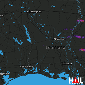 FORT POLK (KPOE) RADAR
States Impacted By Hail On March 9, 2026
Louisiana
·
Mississippi
Counties Impacted By Hail On March 9, 2026
Allen, LA
·
Caldwell, LA
·
Catahoula, LA
·
Concordia, LA
·
East Feliciana, LA
·
Jackson, LA
·
Livingston, LA
·
Madison, LA
·
Natchitoches, LA
·
Rapides, LA
·
St. Helena, LA
·
St. Landry, LA
·
Tangipahoa, LA
·
Tensas, LA
·
Vernon, LA
·
Winn, LA
·
Adams, MS
·
Amite, MS
·
Claiborne, MS
·
Franklin, MS
·
Jefferson, MS
·
Lincoln, MS
·
Pike, MS
·
Warren, MS
·
Wilkinson, MS
Cities Impacted By Hail On March 9, 2026
Clayton, LA
·
Clinton, LA
·
Cloverdale, MS
·
Fayette, MS
·
Greensburg, LA
·
Harrisonburg, LA
·
Liberty, MS
·
Minorca, LA
·
Mound, LA
·
Newellton, LA
·
Sikes, LA
·
Spokane, LA
·
Wallace Ridge, LA
Zip Codes Impacted By Hail On March 9, 2026
39069
·
39086
·
39096
·
39120
·
39150
·
39175
·
39180
·
39629
·
39633
·
39638
·
39645
·
39653
·
39661
·
39664
·
39666
·
70422
·
70441
·
70444
·
70453
·
70456
·
70570
·
70577
·
70639
·
70655
·
70656
·
70722
·
70730
·
70744
·
70761
·
70777
·
70785
·
71226
·
71282
·
71302
·
71303
·
71316
·
71326
·
71334
·
71340
·
71343
·
71346
·
71354
·
71357
·
71368
·
71373
·
71375
·
71404
·
71409
·
71418
·
71435
·
71438
·
71446
·
71447
·
71454
·
71457
·
71463
·
71472
·
71473

