This weather event on March 7, 2026 includes:
3 states
29 counties,
24 cities,
and 54 zip codes.
There were 250 total properties that were impacted and have possible damage.
States Impacted By Hail On March 7, 2026
Alabama
·
Florida
·
Georgia
Counties Impacted By Hail On March 7, 2026
Autauga, AL
·
Chambers, AL
·
Dale, AL
·
Elmore, AL
·
Fayette, AL
·
Geneva, AL
·
Henry, AL
·
Houston, AL
·
Lee, AL
·
Macon, AL
·
Montgomery, AL
·
Pickens, AL
·
Randolph, AL
·
Tallapoosa, AL
·
Tuscaloosa, AL
·
Walker, AL
·
Wilcox, AL
·
Winston, AL
·
Jackson, FL
·
Carroll, GA
·
Clay, GA
·
Coweta, GA
·
DeKalb, GA
·
Early, GA
·
Gwinnett, GA
·
Heard, GA
·
Rockdale, GA
·
Troup, GA
·
Walton, GA
Cities Impacted By Hail On March 7, 2026
Ashford, AL
·
Autaugaville, AL
·
Berry, AL
·
Camden, AL
·
Centralhatchee, GA
·
Conyers, GA
·
Dothan, AL
·
Five Points, AL
·
Fort Gaines, GA
·
Fredonia, AL
·
Lakeview Estates, GA
·
Lithonia, GA
·
Loganville, GA
·
Montgomery, AL
·
Newnan, GA
·
Opelika, AL
·
Ozark, AL
·
Redan, GA
·
Redland, AL
·
Snellville, GA
·
Standing Rock, AL
·
Taylor, AL
·
Tuskegee, AL
·
Webb, AL
Zip Codes Impacted By Hail On March 7, 2026
30052
·
30058
·
30078
·
30087
·
30088
·
30116
·
30185
·
30217
·
30240
·
30263
·
32440
·
35010
·
35503
·
35504
·
35541
·
35542
·
35546
·
35549
·
35553
·
35555
·
35587
·
36003
·
36024
·
36069
·
36078
·
36083
·
36093
·
36105
·
36108
·
36116
·
36274
·
36301
·
36303
·
36305
·
36312
·
36319
·
36320
·
36360
·
36370
·
36373
·
36376
·
36726
·
36801
·
36855
·
36862
·
36863
·
36866
·
39823
·
39851
·
30012
·
30017
·
30039
·
30047
·
36852
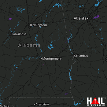 MONTGOMERY (KMXX) RADAR

