This weather event on March 5, 2026 includes:
2 states
20 counties,
31 cities,
and 72 zip codes.
There were total properties that were impacted and have possible damage.
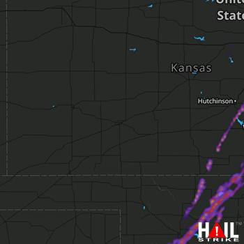 DODGE CITY (KDDC) RADAR
States Impacted By Hail On March 5, 2026
Kansas
·
Oklahoma
Counties Impacted By Hail On March 5, 2026
Barber, KS
·
Ellsworth, KS
·
Harper, KS
·
Harvey, KS
·
Kingman, KS
·
Lincoln, KS
·
McPherson, KS
·
Reno, KS
·
Sedgwick, KS
·
Sumner, KS
·
Alfalfa, OK
·
Blaine, OK
·
Custer, OK
·
Dewey, OK
·
Ellis, OK
·
Garfield, OK
·
Grant, OK
·
Major, OK
·
Roger Mills, OK
·
Woods, OK
Cities Impacted By Hail On March 5, 2026
Aline, OK
·
Bluff City, KS
·
Buhler, KS
·
Burrton, KS
·
Canton, KS
·
Capron, OK
·
Cherokee, OK
·
Cleo Springs, OK
·
Dacoma, OK
·
Fairview, OK
·
Goltry, OK
·
Haven, KS
·
Hazelton, KS
·
Helena, OK
·
Jet, OK
·
Kingman, KS
·
Leedey, OK
·
Mayfield, KS
·
Meno, OK
·
Moundridge, KS
·
Mulvane, KS
·
Nash, OK
·
Nescatunga, OK
·
Putnam, OK
·
Ringwood, OK
·
Seiling, OK
·
Spivey, KS
·
Taloga, OK
·
Wakita, OK
·
Wellington, KS
·
Yoder, KS
Zip Codes Impacted By Hail On March 5, 2026
67003
·
67004
·
67009
·
67013
·
67018
·
67020
·
67022
·
67026
·
67031
·
67049
·
67056
·
67058
·
67061
·
67068
·
67070
·
67103
·
67105
·
67107
·
67111
·
67138
·
67140
·
67142
·
67152
·
67159
·
67443
·
67444
·
67454
·
67455
·
67464
·
67501
·
67522
·
67543
·
67570
·
73628
·
73638
·
73639
·
73663
·
73726
·
73728
·
73729
·
73731
·
73737
·
73739
·
73741
·
73746
·
73749
·
73755
·
73758
·
73759
·
73760
·
73761
·
73766
·
73768
·
73771
·
73835
·
73838
·
73859
·
73860
·
73724
·
73722
·
73717
·
73716
·
73667
·
73659
·
73658
·
73654
·
73650
·
67439
·
67428
·
67425
·
67423
·
67120

