This weather event on March 4, 2026 includes:
3 states
21 counties,
18 cities,
and 68 zip codes.
There were 14 total properties that were impacted and have possible damage.
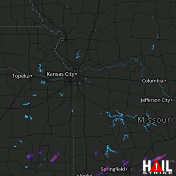 KANSAS CITY (KEAX) RADAR
States Impacted By Hail On March 4, 2026
Kansas
·
Missouri
·
Oklahoma
Counties Impacted By Hail On March 4, 2026
Bourbon, KS
·
Crawford, KS
·
Labette, KS
·
Neosho, KS
·
Wilson, KS
·
Barton, MO
·
Bates, MO
·
Cedar, MO
·
Dade, MO
·
Greene, MO
·
Henry, MO
·
Jasper, MO
·
Johnson, MO
·
Laclede, MO
·
Lawrence, MO
·
Newton, MO
·
Pettis, MO
·
Polk, MO
·
Webster, MO
·
Wright, MO
·
Ottawa, OK
Cities Impacted By Hail On March 4, 2026
Altoona, KS
·
Ash Grove, MO
·
Earlton, KS
·
Erie, KS
·
Fredonia, KS
·
Hoberg, MO
·
Knob Noster, MO
·
Marshfield, MO
·
Miller, MO
·
Mount Vernon, MO
·
Niangua, MO
·
Parsons, KS
·
Rogersville, MO
·
Sarcoxie, MO
·
Springfield, MO
·
Strafford, MO
·
Whiteman AFB, MO
·
Willard, MO
Zip Codes Impacted By Hail On March 4, 2026
64722
·
64730
·
64735
·
64755
·
64756
·
64804
·
64840
·
64848
·
64850
·
64859
·
64862
·
64873
·
65305
·
65336
·
65345
·
65350
·
65470
·
65536
·
65543
·
65612
·
65617
·
65632
·
65646
·
65648
·
65652
·
65667
·
65682
·
65706
·
65707
·
65710
·
65711
·
65712
·
65746
·
65752
·
65756
·
65757
·
65769
·
65770
·
65781
·
65802
·
65804
·
65807
·
65809
·
66701
·
66710
·
66720
·
66733
·
66736
·
66746
·
66753
·
66757
·
66771
·
67357
·
74354
·
74370
·
66780
·
66776
·
66743
·
65803
·
65785
·
65742
·
65725
·
65713
·
65662
·
65605
·
65604
·
64759
·
64720

