This weather event on February 21, 2026 includes:
3 states
29 counties,
13 cities,
and 57 zip codes.
There were 587 total properties that were impacted and have possible damage.
States Impacted By Hail On February 21, 2026
Alabama
·
Florida
·
Georgia
Counties Impacted By Hail On February 21, 2026
Barbour, AL
·
Coffee, AL
·
Covington, AL
·
Crenshaw, AL
·
Dale, AL
·
Geneva, AL
·
Henry, AL
·
Houston, AL
·
Pike, AL
·
Gadsden, FL
·
Leon, FL
·
Liberty, FL
·
Wakulla, FL
·
Baker, GA
·
Ben Hill, GA
·
Calhoun, GA
·
Clay, GA
·
Crisp, GA
·
Dougherty, GA
·
Early, GA
·
Irwin, GA
·
Lee, GA
·
Marion, GA
·
Miller, GA
·
Randolph, GA
·
Schley, GA
·
Sumter, GA
·
Terrell, GA
·
Tift, GA
Cities Impacted By Hail On February 21, 2026
Abbeville, AL
·
Ariton, AL
·
Arlington, GA
·
Blakely, GA
·
Bronwood, GA
·
Cordele, GA
·
Crawfordville, FL
·
Dothan, AL
·
Elba, AL
·
Headland, AL
·
Newville, AL
·
Ocilla, GA
·
Tallahassee, FL
Zip Codes Impacted By Hail On February 21, 2026
31750
·
31764
·
31774
·
31793
·
31803
·
32327
·
32334
·
32358
·
36009
·
36010
·
36017
·
36034
·
36035
·
36079
·
36303
·
36310
·
36311
·
36317
·
36323
·
36343
·
36345
·
36346
·
36350
·
36353
·
36360
·
36374
·
36442
·
36453
·
36467
·
36477
·
39813
·
39823
·
39824
·
39826
·
39840
·
39841
·
39842
·
39846
·
39862
·
39866
·
39867
·
39886
·
31015
·
31092
·
31709
·
31712
·
31721
·
31743
·
31806
·
32301
·
32303
·
32304
·
32305
·
32308
·
32310
·
32312
·
32351
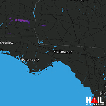 TALLAHASSEE (KTLH) RADAR

