This weather event on February 19, 2026 includes:
3 states
16 counties,
10 cities,
and 66 zip codes.
There were total properties that were impacted and have possible damage.
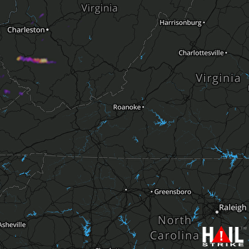 ROANOKE (KFCX) RADAR
States Impacted By Hail On February 19, 2026
Kentucky
·
Virginia
·
West Virginia
Counties Impacted By Hail On February 19, 2026
Floyd, KY
·
Johnson, KY
·
Martin, KY
·
Pike, KY
·
Buchanan, VA
·
Boone, WV
·
Calhoun, WV
·
Clay, WV
·
Jackson, WV
·
Kanawha, WV
·
Lincoln, WV
·
Logan, WV
·
Mingo, WV
·
Putnam, WV
·
Raleigh, WV
·
Roane, WV
Cities Impacted By Hail On February 19, 2026
Big Creek, WV
·
Chapmanville, WV
·
Charleston, WV
·
Harts, WV
·
Marmet, WV
·
Phelps, KY
·
Rand, WV
·
Teays Valley, WV
·
Twilight, WV
·
Van, WV
Zip Codes Impacted By Hail On February 19, 2026
24620
·
25003
·
25009
·
25021
·
25022
·
25028
·
25030
·
25043
·
25045
·
25047
·
25121
·
25124
·
25140
·
25149
·
25159
·
25181
·
25183
·
25204
·
25208
·
25209
·
25213
·
25234
·
25248
·
25276
·
25304
·
25306
·
25312
·
25314
·
25505
·
25508
·
25524
·
25526
·
25547
·
25560
·
25601
·
25666
·
25671
·
26141
·
26147
·
26151
·
41204
·
41214
·
41224
·
41250
·
41262
·
41265
·
41501
·
41514
·
41539
·
41543
·
41553
·
41554
·
41555
·
41557
·
41562
·
41568
·
25320
·
25315
·
25206
·
25114
·
25108
·
25107
·
25093
·
25088
·
25053
·
25015

