This weather event on February 19, 2026 includes:
2 states
22 counties,
18 cities,
and 58 zip codes.
There were total properties that were impacted and have possible damage.
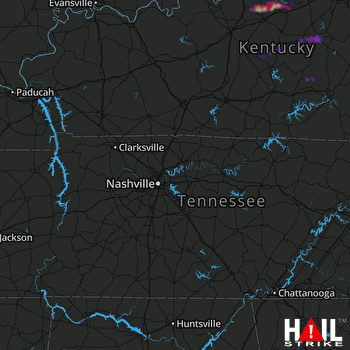 NASHVILLE (KOHX) RADAR
States Impacted By Hail On February 19, 2026
Indiana
·
Kentucky
Counties Impacted By Hail On February 19, 2026
Crawford, IN
·
Harrison, IN
·
Perry, IN
·
Spencer, IN
·
Anderson, KY
·
Boyle, KY
·
Breckinridge, KY
·
Bullitt, KY
·
Casey, KY
·
Garrard, KY
·
Green, KY
·
Hart, KY
·
Jefferson, KY
·
Larue, KY
·
Lincoln, KY
·
Marion, KY
·
Meade, KY
·
Nelson, KY
·
Pulaski, KY
·
Spencer, KY
·
Taylor, KY
·
Washington, KY
Cities Impacted By Hail On February 19, 2026
Alton, IN
·
Bloomfield, KY
·
Brandenburg, KY
·
Brooks, KY
·
Chaplin, KY
·
Danville, KY
·
Fairfield, KY
·
Fox Chase, KY
·
Hillview, KY
·
Junction City, KY
·
Laconia, IN
·
Lancaster, KY
·
Lebanon, KY
·
Mauckport, IN
·
Mount Washington, KY
·
New Middletown, IN
·
Pioneer Village, KY
·
Shepherdsville, KY
Zip Codes Impacted By Hail On February 19, 2026
40047
·
40060
·
40071
·
40104
·
40108
·
40109
·
40118
·
40146
·
40150
·
40157
·
40165
·
40170
·
40171
·
40176
·
40229
·
40272
·
40328
·
40440
·
40444
·
40468
·
40484
·
42516
·
42539
·
42553
·
42565
·
42713
·
42716
·
42718
·
42722
·
42757
·
42765
·
42776
·
42784
·
47110
·
47117
·
47135
·
47586
·
47588
·
47551
·
47525
·
47520
·
47160
·
47142
·
47137
·
47112
·
40464
·
40422
·
40342
·
40177
·
40078
·
40046
·
40033
·
40020
·
40013
·
40012
·
40009
·
40008
·
40004

