This weather event on November 18, 2025 includes:
2 states
20 counties,
22 cities,
and 93 zip codes.
There were 1311 total properties that were impacted and have possible damage.
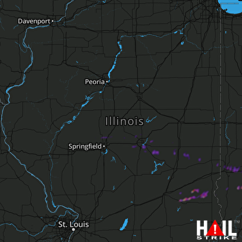 LINCOLN (KILX) RADAR
States Impacted By Hail On November 18, 2025
Illinois
·
Indiana
Counties Impacted By Hail On November 18, 2025
Christian, IL
·
Clark, IL
·
Coles, IL
·
Crawford, IL
·
Cumberland, IL
·
Douglas, IL
·
Edgar, IL
·
Effingham, IL
·
Jasper, IL
·
Logan, IL
·
Macon, IL
·
Menard, IL
·
Moultrie, IL
·
Piatt, IL
·
Sangamon, IL
·
Clay, IN
·
Owen, IN
·
Putnam, IN
·
Sullivan, IN
·
Vigo, IN
Cities Impacted By Hail On November 18, 2025
Annapolis, IL
·
Cantrall, IL
·
Center Point, IN
·
Cerro Gordo, IL
·
Coalmont, IN
·
Decatur, IL
·
Dresser, IN
·
Hindsboro, IL
·
Long Creek, IL
·
Lovington, IL
·
Mount Zion, IL
·
North Terre Haute, IN
·
Seelyville, IN
·
Staunton, IN
·
St. Mary of the Woods, IN
·
Terre Haute, IN
·
Teutopolis, IL
·
Vermilion, IL
·
Warrensburg, IL
·
Wheeler, IL
·
Williamsville, IL
·
Yale, IL
Zip Codes Impacted By Hail On November 18, 2025
47802
·
47803
·
47804
·
47805
·
47807
·
47809
·
47833
·
47834
·
47840
·
47841
·
47846
·
47850
·
47858
·
47861
·
47868
·
47876
·
47879
·
47881
·
61910
·
61911
·
61913
·
61914
·
61917
·
61919
·
61920
·
61925
·
61929
·
61930
·
61933
·
61937
·
61943
·
61944
·
61949
·
61951
·
61953
·
62413
·
62420
·
62428
·
62432
·
62433
·
62436
·
62442
·
62445
·
62448
·
62449
·
62451
·
62454
·
62467
·
62478
·
62479
·
62480
·
62481
·
62501
·
62515
·
62521
·
62522
·
62526
·
62531
·
62532
·
62535
·
62539
·
62547
·
62548
·
62549
·
62551
·
62554
·
62561
·
62563
·
62573
·
62613
·
62625
·
62675
·
62684
·
62688
·
62693
·
62707
·
46105
·
46120
·
46172
·
47427
·
47431
·
47438
·
47456
·
47460
·
47471
·
47849
·
47885
·
61756
·
61813
·
61818
·
61872
·
62513
·
62544

