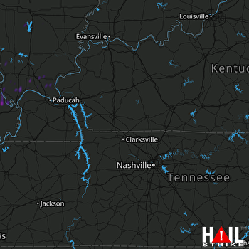
This weather event on November 18, 2025 includes:
4 states
21 counties,
22 cities,
and 67 zip codes.
There were total properties that were impacted and have possible damage.
States Impacted By Hail On November 18, 2025
Illinois
·
Indiana
·
Kentucky
·
Missouri
Counties Impacted By Hail On November 18, 2025
Alexander, IL
·
Franklin, IL
·
Hamilton, IL
·
Jackson, IL
·
Jefferson, IL
·
Johnson, IL
·
Lawrence, IL
·
Massac, IL
·
Pope, IL
·
Pulaski, IL
·
Union, IL
·
Knox, IN
·
Ballard, KY
·
Caldwell, KY
·
Crittenden, KY
·
Daviess, KY
·
Livingston, KY
·
Cape Girardeau, MO
·
Perry, MO
·
Scott, MO
·
Stoddard, MO
Cities Impacted By Hail On November 18, 2025
Altenburg, MO
·
Belle Rive, IL
·
Benton, MO
·
Cape Girardeau, MO
·
Chaffee, MO
·
Commerce, MO
·
Dahlgren, IL
·
Delta, MO
·
Fredonia, KY
·
Golconda, IL
·
Gordonville, MO
·
Grand Tower, IL
·
Jackson, MO
·
Karnak, IL
·
Makanda, IL
·
Mill Creek, IL
·
Morley, MO
·
New Grand Chain, IL
·
Pulaski, IL
·
Thebes, IL
·
Ullin, IL
·
Whitewater, MO
Zip Codes Impacted By Hail On November 18, 2025
42024
·
42028
·
42056
·
42064
·
42078
·
42083
·
42366
·
62816
·
62828
·
62941
·
62942
·
62943
·
62952
·
62956
·
62957
·
62958
·
62960
·
62966
·
62969
·
62970
·
62975
·
62976
·
62985
·
62988
·
62990
·
62992
·
62995
·
62996
·
62998
·
63701
·
63736
·
63740
·
63742
·
63744
·
63745
·
63748
·
63755
·
63785
·
63801
·
63834
·
63780
·
63774
·
63771
·
63767
·
63735
·
63732
·
63730
·
63703
·
62962
·
62938
·
62928
·
62926
·
62923
·
62910
·
62908
·
62906
·
62905
·
62903
·
62902
·
62894
·
62884
·
62883
·
62810
·
62460
·
62439
·
47591
·
42411
 FORT CAMPBELL (KHPX) RADAR

