This weather event on November 17, 2025 includes:
2 states
17 counties,
22 cities,
and 59 zip codes.
There were 610 total properties that were impacted and have possible damage.
States Impacted By Hail On November 17, 2025
Illinois
·
Indiana
Counties Impacted By Hail On November 17, 2025
Bond, IL
·
Clay, IL
·
Clinton, IL
·
Crawford, IL
·
Effingham, IL
·
Fayette, IL
·
Jasper, IL
·
Jefferson, IL
·
Madison, IL
·
Marion, IL
·
Montgomery, IL
·
Shelby, IL
·
Washington, IL
·
Wayne, IL
·
White, IL
·
Gibson, IN
·
Posey, IN
Cities Impacted By Hail On November 17, 2025
Central City, IL
·
Centralia, IL
·
Cisne, IL
·
Coalton, IL
·
Coffeen, IL
·
Fillmore, IL
·
Greenville, IL
·
Herrick, IL
·
Hillsboro, IL
·
Johnsonville, IL
·
Kell, IL
·
Litchfield, IL
·
Nokomis, IL
·
Oblong, IL
·
Oconee, IL
·
Owensville, IN
·
Robinson, IL
·
Stoy, IL
·
Walnut Hill, IL
·
Wamac, IL
·
Wenonah, IL
·
Witt, IL
Zip Codes Impacted By Hail On November 17, 2025
62885
·
62882
·
62881
·
62015
·
62017
·
62032
·
62051
·
62056
·
62074
·
62075
·
62080
·
62083
·
62094
·
62216
·
62230
·
62246
·
62249
·
62262
·
62275
·
62281
·
62284
·
62293
·
62411
·
62414
·
62418
·
62422
·
62431
·
62443
·
62449
·
62454
·
62458
·
62471
·
62481
·
62538
·
62553
·
62557
·
62560
·
62801
·
62814
·
62823
·
62827
·
62830
·
62842
·
62849
·
62850
·
62851
·
62853
·
62858
·
62875
·
62889
·
62893
·
62899
·
62880
·
62838
·
62049
·
62011
·
62001
·
47665
·
47616
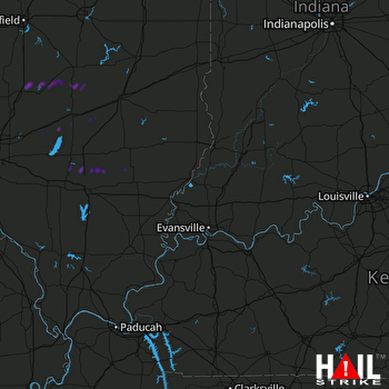 EVANSVILLE (KVWX) RADAR

