This weather event on November 9, 2025 includes:
2 states
26 counties,
13 cities,
and 63 zip codes.
There were total properties that were impacted and have possible damage.
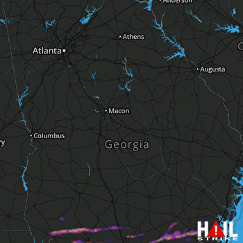 ROBINS AFB (KJGX) RADAR
States Impacted By Hail On November 9, 2025
Florida
·
Georgia
Counties Impacted By Hail On November 9, 2025
Jefferson, FL
·
Madison, FL
·
Baker, GA
·
Berrien, GA
·
Brantley, GA
·
Brooks, GA
·
Bulloch, GA
·
Camden, GA
·
Charlton, GA
·
Clinch, GA
·
Coffee, GA
·
Colquitt, GA
·
Cook, GA
·
Decatur, GA
·
Echols, GA
·
Evans, GA
·
Glynn, GA
·
Grady, GA
·
Irwin, GA
·
Lanier, GA
·
Lowndes, GA
·
Miller, GA
·
Mitchell, GA
·
Tattnall, GA
·
Thomas, GA
·
Ware, GA
Cities Impacted By Hail On November 9, 2025
Bainbridge, GA
·
Berlin, GA
·
Boston, GA
·
Cairo, GA
·
Cecil, GA
·
Coolidge, GA
·
Dasher, GA
·
Douglas, GA
·
Echols County, GA
·
Meigs, GA
·
Quitman, GA
·
Thomasville, GA
·
Valdosta, GA
Zip Codes Impacted By Hail On November 9, 2025
31523
·
31533
·
31535
·
31537
·
31542
·
31550
·
31553
·
31565
·
31566
·
31568
·
31601
·
31602
·
31605
·
31627
·
31630
·
31631
·
31632
·
31634
·
31636
·
31638
·
31641
·
31643
·
31648
·
31649
·
31720
·
31722
·
31730
·
31738
·
31757
·
31765
·
31768
·
31778
·
31788
·
31792
·
32331
·
32344
·
32350
·
39817
·
39825
·
39827
·
39828
·
39834
·
39837
·
39870
·
39897
·
32340
·
31779
·
31774
·
31773
·
31645
·
31629
·
31626
·
31625
·
31620
·
31606
·
31503
·
30461
·
30458
·
30453
·
30452
·
30427
·
30417
·
30415

