This weather event on November 9, 2025 includes:
2 states
24 counties,
25 cities,
and 74 zip codes.
There were 11895 total properties that were impacted and have possible damage.
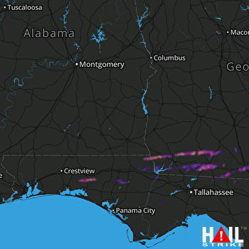 FORT RUCKER (KEOX) RADAR
States Impacted By Hail On November 9, 2025
Florida
·
Georgia
Counties Impacted By Hail On November 9, 2025
Bay, FL
·
Calhoun, FL
·
Gadsden, FL
·
Holmes, FL
·
Jackson, FL
·
Jefferson, FL
·
Liberty, FL
·
Madison, FL
·
Wakulla, FL
·
Walton, FL
·
Washington, FL
·
Baker, GA
·
Berrien, GA
·
Brooks, GA
·
Colquitt, GA
·
Cook, GA
·
Decatur, GA
·
Early, GA
·
Grady, GA
·
Lanier, GA
·
Lowndes, GA
·
Mitchell, GA
·
Seminole, GA
·
Thomas, GA
Cities Impacted By Hail On November 9, 2025
Adel, GA
·
Bascom, FL
·
Berlin, GA
·
Boston, GA
·
Brinson, GA
·
Cairo, GA
·
Calvary, GA
·
Caryville, FL
·
Cecil, GA
·
Chattahoochee, FL
·
Coolidge, GA
·
Cottondale, FL
·
DeFuniak Springs, FL
·
Graceville, FL
·
Greenwood, FL
·
Hosford, FL
·
Iron City, GA
·
Marianna, FL
·
Meigs, GA
·
Quitman, GA
·
Thomasville, GA
·
Valdosta, GA
·
Vernon, FL
·
Wausau, FL
·
Westville, FL
Zip Codes Impacted By Hail On November 9, 2025
31601
·
31602
·
31605
·
31606
·
31620
·
31625
·
31626
·
31627
·
31629
·
31632
·
31636
·
31639
·
31641
·
31643
·
31645
·
31720
·
31722
·
31738
·
31757
·
31765
·
31768
·
31773
·
31788
·
31792
·
32321
·
32324
·
32331
·
32340
·
32344
·
32350
·
32351
·
32352
·
32358
·
32404
·
32428
·
32431
·
32435
·
32438
·
32439
·
32440
·
32442
·
32443
·
32446
·
32448
·
32455
·
32460
·
32462
·
32463
·
32464
·
32466
·
39815
·
39817
·
39819
·
39823
·
39825
·
39827
·
39828
·
39834
·
39837
·
39845
·
39859
·
39897
·
39870
·
32445
·
32427
·
32426
·
32425
·
32423
·
32421
·
32420
·
32334
·
31779
·
31778
·
31730

