This weather event on October 24, 2025 includes:
3 states
35 counties,
13 cities,
and 82 zip codes.
There were 3130 total properties that were impacted and have possible damage.
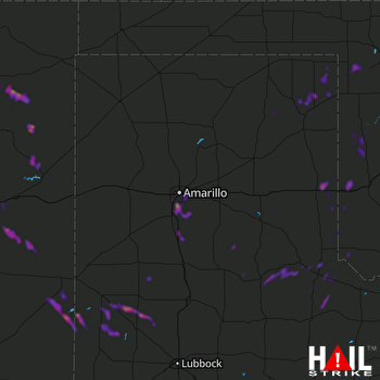 AMARILLO (KAMA) RADAR
States Impacted By Hail On October 24, 2025
New Mexico
·
Oklahoma
·
Texas
Counties Impacted By Hail On October 24, 2025
Curry, NM
·
Harding, NM
·
Quay, NM
·
Roosevelt, NM
·
San Miguel, NM
·
Union, NM
·
Beaver, OK
·
Beckham, OK
·
Ellis, OK
·
Harmon, OK
·
Harper, OK
·
Roger Mills, OK
·
Bailey, TX
·
Briscoe, TX
·
Carson, TX
·
Castro, TX
·
Childress, TX
·
Collingsworth, TX
·
Cottle, TX
·
Dickens, TX
·
Donley, TX
·
Gray, TX
·
Hale, TX
·
Hall, TX
·
Hardeman, TX
·
Hartley, TX
·
Hemphill, TX
·
Lamb, TX
·
Lipscomb, TX
·
Motley, TX
·
Potter, TX
·
Randall, TX
·
Roberts, TX
·
Swisher, TX
·
Wheeler, TX
Cities Impacted By Hail On October 24, 2025
Amarillo, TX
·
Canyon, TX
·
Causey, NM
·
Cheyenne, OK
·
Dimmitt, TX
·
Dodson, TX
·
Erick, OK
·
Hollis, OK
·
Mosquero, NM
·
Palisades, TX
·
Portales, NM
·
Spade, TX
·
Timbercreek Canyon, TX
Zip Codes Impacted By Hail On October 24, 2025
73840
·
73843
·
73848
·
73858
·
79014
·
79015
·
79022
·
79027
·
79034
·
79041
·
79042
·
79043
·
79046
·
79056
·
79057
·
79059
·
79061
·
79063
·
79065
·
79068
·
79079
·
79088
·
79095
·
79096
·
79102
·
79103
·
79104
·
79107
·
79109
·
79118
·
79324
·
79339
·
87746
·
88101
·
88113
·
88120
·
88124
·
88130
·
88132
·
88401
·
88415
·
88422
·
88424
·
88426
·
88427
·
88410
·
87743
·
87733
·
79371
·
79369
·
79347
·
79326
·
79313
·
79312
·
79311
·
79261
·
79259
·
79257
·
79256
·
79255
·
79252
·
79248
·
79245
·
79237
·
79234
·
79233
·
79230
·
79226
·
79220
·
79201
·
79124
·
79121
·
79119
·
79110
·
73662
·
73660
·
73645
·
73642
·
73638
·
73628
·
73571
·
73550

