This weather event on October 24, 2025 includes:
3 states
22 counties,
15 cities,
and 63 zip codes.
There were total properties that were impacted and have possible damage.
States Impacted By Hail On October 24, 2025
Kansas
·
Oklahoma
·
Texas
Counties Impacted By Hail On October 24, 2025
Ellsworth, KS
·
Harper, KS
·
Harvey, KS
·
Kingman, KS
·
Lincoln, KS
·
McPherson, KS
·
Reno, KS
·
Russell, KS
·
Saline, KS
·
Sedgwick, KS
·
Sumner, KS
·
Alfalfa, OK
·
Beaver, OK
·
Ellis, OK
·
Grant, OK
·
Harper, OK
·
Major, OK
·
Woods, OK
·
Woodward, OK
·
Hemphill, TX
·
Lipscomb, TX
·
Roberts, TX
Cities Impacted By Hail On October 24, 2025
Andale, KS
·
Bluff City, KS
·
Caldwell, KS
·
Cheney, KS
·
Falun, KS
·
Follett, TX
·
Gage, OK
·
Goddard, KS
·
Manchester, OK
·
Marquette, KS
·
Mooreland, OK
·
Newton, KS
·
North Newton, KS
·
Norwich, KS
·
Wichita, KS
Zip Codes Impacted By Hail On October 24, 2025
67001
·
67003
·
67018
·
67022
·
67025
·
67026
·
67030
·
67031
·
67050
·
67052
·
67056
·
67058
·
67068
·
67106
·
67108
·
67111
·
67114
·
67117
·
67118
·
67135
·
67149
·
67152
·
67202
·
67203
·
67209
·
67212
·
67213
·
67215
·
67217
·
67227
·
67425
·
67439
·
67442
·
67455
·
67456
·
67460
·
67464
·
67481
·
67490
·
67626
·
67634
·
67648
·
73717
·
73758
·
73759
·
73801
·
73852
·
73858
·
73859
·
73860
·
79014
·
79034
·
79059
·
73848
·
73843
·
73842
·
73840
·
73834
·
73832
·
67454
·
67216
·
67142
·
67036
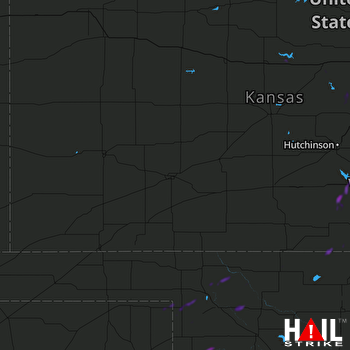 DODGE CITY (KDDC) RADAR

