This weather event on October 23, 2025 includes:
2 states
19 counties,
17 cities,
and 60 zip codes.
There were 663 total properties that were impacted and have possible damage.
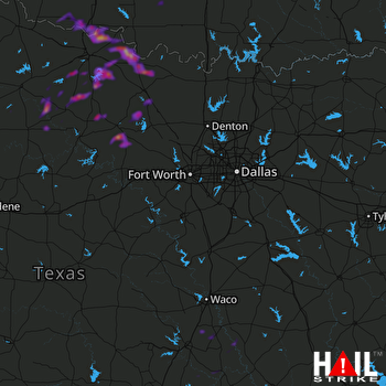 DALLAS/FTW (KFWS) RADAR
States Impacted By Hail On October 23, 2025
Oklahoma
·
Texas
Counties Impacted By Hail On October 23, 2025
Cotton, OK
·
Jefferson, OK
·
Stephens, OK
·
Tillman, OK
·
Archer, TX
·
Baylor, TX
·
Bell, TX
·
Clay, TX
·
Falls, TX
·
Haskell, TX
·
Jack, TX
·
Knox, TX
·
Milam, TX
·
Montague, TX
·
Robertson, TX
·
Throckmorton, TX
·
Wichita, TX
·
Wise, TX
·
Young, TX
Cities Impacted By Hail On October 23, 2025
Byers, TX
·
Cameron, TX
·
Devol, OK
·
Elbert, TX
·
Goree, TX
·
Grandfield, OK
·
Henrietta, TX
·
Megargel, TX
·
Nocona, TX
·
Perrin, TX
·
Petrolia, TX
·
Randlett, OK
·
Scotland, TX
·
Sunset, TX
·
Terral, OK
·
Windthorst, TX
·
Woodson, TX
Zip Codes Impacted By Hail On October 23, 2025
73531
·
73546
·
73548
·
73553
·
73562
·
73565
·
73568
·
73569
·
73572
·
73573
·
76230
·
76251
·
76255
·
76261
·
76270
·
76305
·
76310
·
76351
·
76354
·
76357
·
76363
·
76365
·
76366
·
76370
·
76371
·
76372
·
76374
·
76377
·
76379
·
76380
·
76388
·
76389
·
76426
·
76431
·
76450
·
76458
·
76459
·
76460
·
76483
·
76486
·
76491
·
76511
·
76518
·
76520
·
76523
·
76524
·
76680
·
76661
·
76656
·
76632
·
76629
·
76579
·
76570
·
76534
·
76228
·
73533
·
73530
·
73528
·
73481
·
73442

