This weather event on October 18, 2025 includes:
1 states
23 counties,
26 cities,
and 70 zip codes.
There were 6062 total properties that were impacted and have possible damage.
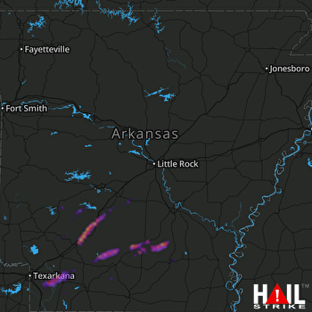 LITTLE ROCK (KLZK) RADAR
States Impacted By Hail On October 18, 2025
Arkansas
Counties Impacted By Hail On October 18, 2025
Ashley, AR
·
Bradley, AR
·
Calhoun, AR
·
Chicot, AR
·
Clark, AR
·
Cleveland, AR
·
Dallas, AR
·
Drew, AR
·
Faulkner, AR
·
Garland, AR
·
Grant, AR
·
Hempstead, AR
·
Hot Spring, AR
·
Lafayette, AR
·
Lincoln, AR
·
Miller, AR
·
Nevada, AR
·
Ouachita, AR
·
Perry, AR
·
Pike, AR
·
Pulaski, AR
·
Van Buren, AR
·
Yell, AR
Cities Impacted By Hail On October 18, 2025
Arkadelphia, AR
·
Bearden, AR
·
Chidester, AR
·
Donaldson, AR
·
Fordyce, AR
·
Garland, AR
·
Gibson, AR
·
Gum Springs, AR
·
Kirby, AR
·
Lake Village, AR
·
Lewisville, AR
·
Malvern, AR
·
McCaskill, AR
·
Midway, AR
·
New Edinburg, AR
·
North Little Rock, AR
·
Ozan, AR
·
Patmos, AR
·
Perrytown, AR
·
Poyen, AR
·
Prescott, AR
·
Rosston, AR
·
Sherwood, AR
·
Thornton, AR
·
Warren, AR
·
Willisville, AR
Zip Codes Impacted By Hail On October 18, 2025
72853
·
72842
·
72824
·
72173
·
72167
·
72153
·
72129
·
72128
·
72120
·
72118
·
72114
·
72106
·
72104
·
72084
·
72076
·
72032
·
72031
·
72025
·
72015
·
71999
·
71998
·
71968
·
71962
·
71958
·
71950
·
71941
·
71940
·
71933
·
71929
·
71923
·
71921
·
71862
·
71860
·
71858
·
71857
·
71855
·
71854
·
71847
·
71845
·
71839
·
71838
·
71837
·
71835
·
71827
·
71825
·
71801
·
71770
·
71766
·
71764
·
71763
·
71751
·
71744
·
71743
·
71742
·
71726
·
71722
·
71720
·
71701
·
71675
·
71671
·
71667
·
71665
·
71660
·
71655
·
71653
·
71652
·
71646
·
71642
·
71638
·
71631

