This weather event on October 18, 2025 includes:
2 states
24 counties,
18 cities,
and 65 zip codes.
There were 215 total properties that were impacted and have possible damage.
States Impacted By Hail On October 18, 2025
Oklahoma
·
Texas
Counties Impacted By Hail On October 18, 2025
Carter, OK
·
Garvin, OK
·
Jefferson, OK
·
Johnston, OK
·
Love, OK
·
Marshall, OK
·
Murray, OK
·
Pontotoc, OK
·
Archer, TX
·
Baylor, TX
·
Callahan, TX
·
Clay, TX
·
Cooke, TX
·
Eastland, TX
·
Fisher, TX
·
Foard, TX
·
Hardeman, TX
·
Haskell, TX
·
Jack, TX
·
Jones, TX
·
Montague, TX
·
Stephens, TX
·
Stonewall, TX
·
Young, TX
Cities Impacted By Hail On October 18, 2025
Ada, OK
·
Ardmore, OK
·
Bowie, TX
·
Burneyville, OK
·
Connerville, OK
·
Davis, OK
·
Gene Autry, OK
·
Hamlin, TX
·
Haskell, TX
·
Healdton, OK
·
Lone Grove, OK
·
Marietta, OK
·
Ranger, TX
·
Ravia, OK
·
Roby, TX
·
Springer, OK
·
Stamford, TX
·
Wilson, OK
Zip Codes Impacted By Hail On October 18, 2025
79561
·
79560
·
79556
·
79553
·
79548
·
79547
·
79543
·
79534
·
79521
·
79520
·
79503
·
79502
·
79501
·
79252
·
79227
·
79225
·
76470
·
76466
·
76464
·
76460
·
76459
·
76458
·
76450
·
76448
·
76431
·
76429
·
76427
·
76389
·
76380
·
76374
·
76366
·
76365
·
76351
·
76305
·
76265
·
76261
·
76255
·
76252
·
76240
·
76230
·
76228
·
74871
·
74865
·
74856
·
74836
·
74820
·
73569
·
73565
·
73463
·
73460
·
73458
·
73456
·
73455
·
73453
·
73450
·
73448
·
73446
·
73443
·
73438
·
73437
·
73430
·
73401
·
73098
·
73086
·
73030
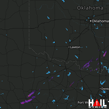 ALTUS AFB (KFDR) RADAR

