This weather event on October 18, 2025 includes:
2 states
14 counties,
20 cities,
and 59 zip codes.
There were 6304 total properties that were impacted and have possible damage.
States Impacted By Hail On October 18, 2025
Kansas
·
Missouri
Counties Impacted By Hail On October 18, 2025
Allen, KS
·
Elk, KS
·
Jefferson, KS
·
Leavenworth, KS
·
Shawnee, KS
·
Wabaunsee, KS
·
Buchanan, MO
·
Caldwell, MO
·
Carroll, MO
·
Clay, MO
·
Clinton, MO
·
Livingston, MO
·
Platte, MO
·
Ray, MO
Cities Impacted By Hail On October 18, 2025
Agency, MO
·
Crystal Lakes, MO
·
Easton, MO
·
Edgerton, MO
·
Excelsior Springs, MO
·
Ferrelview, MO
·
Homestead, MO
·
Kansas City, MO
·
Kearney, MO
·
Lansing, KS
·
Leavenworth, KS
·
Liberty, MO
·
McLouth, KS
·
Mosby, MO
·
Paxico, KS
·
Silver Lake, KS
·
Smithville, MO
·
Trimble, MO
·
Weston, MO
·
Wood Heights, MO
Zip Codes Impacted By Hail On October 18, 2025
67047
·
66755
·
66618
·
66539
·
66526
·
66507
·
66109
·
66086
·
66073
·
66070
·
66066
·
66054
·
66048
·
66044
·
66043
·
66020
·
66007
·
64671
·
64668
·
64664
·
64656
·
64650
·
64644
·
64638
·
64637
·
64625
·
64624
·
64507
·
64492
·
64490
·
64477
·
64465
·
64454
·
64444
·
64443
·
64439
·
64401
·
64167
·
64166
·
64165
·
64164
·
64163
·
64156
·
64155
·
64154
·
64153
·
64152
·
64098
·
64089
·
64085
·
64084
·
64079
·
64068
·
64062
·
64060
·
64048
·
64035
·
64024
·
64018
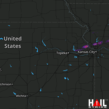 TOPEKA (KTWX) RADAR

