This weather event on October 17, 2025 includes:
2 states
21 counties,
21 cities,
and 69 zip codes.
There were 336 total properties that were impacted and have possible damage.
States Impacted By Hail On October 17, 2025
Iowa
·
Missouri
Counties Impacted By Hail On October 17, 2025
Clarke, IA
·
Decatur, IA
·
Jasper, IA
·
Lucas, IA
·
Mahaska, IA
·
Marion, IA
·
Poweshiek, IA
·
Ringgold, IA
·
Warren, IA
·
Wayne, IA
·
Daviess, MO
·
DeKalb, MO
·
Gentry, MO
·
Grundy, MO
·
Harrison, MO
·
Holt, MO
·
Mercer, MO
·
Nodaway, MO
·
Putnam, MO
·
Sullivan, MO
·
Worth, MO
Cities Impacted By Hail On October 17, 2025
Albany, MO
·
Bethany, MO
·
Corydon, IA
·
Darlington, MO
·
Gallatin, MO
·
Jamesport, MO
·
Knoxville, IA
·
Lake Viking, MO
·
Lucerne, MO
·
Lynnville, IA
·
Maysville, MO
·
McFall, MO
·
Melcher-Dallas, IA
·
New Hampton, MO
·
Pella, IA
·
Pleasanton, IA
·
Promise City, IA
·
Ravanna, MO
·
Unionville, MO
·
Weatherby, MO
·
Woodburn, IA
Zip Codes Impacted By Hail On October 17, 2025
64497
·
64689
·
64673
·
64672
·
64670
·
64667
·
64661
·
64657
·
64655
·
64648
·
64647
·
64645
·
64642
·
64640
·
64636
·
64632
·
64620
·
64490
·
64481
·
64474
·
64473
·
64471
·
64469
·
64463
·
64458
·
64457
·
64456
·
64451
·
64442
·
64441
·
64438
·
64434
·
64429
·
64426
·
64424
·
64423
·
64422
·
64402
·
63565
·
63560
·
52590
·
52583
·
50275
·
50264
·
50251
·
50232
·
50219
·
50213
·
50210
·
50207
·
50166
·
50163
·
50157
·
50153
·
50151
·
50147
·
50144
·
50140
·
50139
·
50138
·
50125
·
50119
·
50103
·
50065
·
50062
·
50060
·
50052
·
50049
·
50008
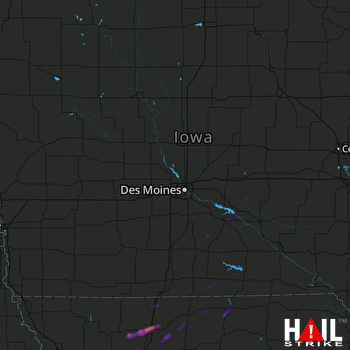 DES MOINES (KDMX) RADAR

