This weather event on October 10, 2025 includes:
5 states
23 counties,
15 cities,
and 71 zip codes.
There were total properties that were impacted and have possible damage.
States Impacted By Hail On October 10, 2025
Iowa
·
Illinois
·
Minnesota
·
Missouri
·
Wisconsin
Counties Impacted By Hail On October 10, 2025
Appanoose, IA
·
Cedar, IA
·
Davis, IA
·
Iowa, IA
·
Jasper, IA
·
Jefferson, IA
·
Jones, IA
·
Linn, IA
·
Lucas, IA
·
Mahaska, IA
·
Marion, IA
·
Monroe, IA
·
Poweshiek, IA
·
Van Buren, IA
·
Wapello, IA
·
Jo Daviess, IL
·
Stephenson, IL
·
Houston, MN
·
Adair, MO
·
Schuyler, MO
·
Scotland, MO
·
Crawford, WI
·
Vernon, WI
Cities Impacted By Hail On October 10, 2025
Amana, IA
·
Cedar Rapids, IA
·
Centerville, IA
·
Douds, IA
·
East Amana, IA
·
Malcom, IA
·
Marion, IA
·
Melcher-Dallas, IA
·
Melrose, IA
·
Moulton, IA
·
Mystic, IA
·
New Sharon, IA
·
Pella, IA
·
Plano, IA
·
Robins, IA
Zip Codes Impacted By Hail On October 10, 2025
50049
·
50057
·
50062
·
50112
·
50119
·
50138
·
50143
·
50150
·
50153
·
50157
·
50163
·
50171
·
50207
·
50219
·
50232
·
50238
·
50251
·
52202
·
52203
·
52214
·
52216
·
52221
·
52222
·
52255
·
52302
·
52305
·
52306
·
52314
·
52328
·
52336
·
52501
·
52531
·
52536
·
52537
·
52542
·
52544
·
52551
·
52553
·
52556
·
52569
·
52570
·
52571
·
52572
·
52574
·
52577
·
52581
·
52585
·
52590
·
52593
·
52594
·
52620
·
53826
·
54624
·
54626
·
54628
·
54631
·
54665
·
55919
·
55921
·
61001
·
61048
·
61085
·
61087
·
63501
·
63533
·
63535
·
63536
·
63546
·
63548
·
63555
·
63561
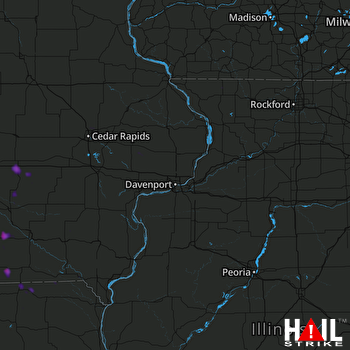 DAVENPORT (KDVN) RADAR

