This weather event on October 6, 2025 includes:
2 states
6 counties,
46 cities,
and 44 zip codes.
There were total properties that were impacted and have possible damage.
States Impacted By Hail On October 6, 2025
Iowa
·
Illinois
Counties Impacted By Hail On October 6, 2025
Lee, IA
·
Cook, IL
·
DeKalb, IL
·
Hancock, IL
·
Lake, IL
·
Stark, IL
Cities Impacted By Hail On October 6, 2025
Arlington Heights, IL
·
Barrington, IL
·
Barrington Hills, IL
·
Bellwood, IL
·
Berwyn, IL
·
Broadview, IL
·
Brookfield, IL
·
Buffalo Grove, IL
·
Deer Park, IL
·
Elmwood Park, IL
·
Forest Lake, IL
·
Forest Park, IL
·
Fort Madison, IA
·
Franklin Park, IL
·
Genoa, IL
·
Grayslake, IL
·
Green Oaks, IL
·
Gurnee, IL
·
Hawthorn Woods, IL
·
Hoffman Estates, IL
·
Inverness, IL
·
Kildeer, IL
·
La Grange Park, IL
·
Lake Barrington, IL
·
Lake Zurich, IL
·
Libertyville, IL
·
Lincolnshire, IL
·
Long Grove, IL
·
Maywood, IL
·
Melrose Park, IL
·
Mettawa, IL
·
Mundelein, IL
·
Nauvoo, IL
·
North Barrington, IL
·
North Riverside, IL
·
Oak Park, IL
·
Palatine, IL
·
Prospect Heights, IL
·
River Forest, IL
·
River Grove, IL
·
Riverside, IL
·
Riverwoods, IL
·
South Barrington, IL
·
Vernon Hills, IL
·
Waukegan, IL
·
Wheeling, IL
Zip Codes Impacted By Hail On October 6, 2025
52627
·
52639
·
60004
·
60010
·
60015
·
60030
·
60031
·
60044
·
60045
·
60047
·
60048
·
60060
·
60061
·
60062
·
60067
·
60069
·
60070
·
60074
·
60089
·
60090
·
60104
·
60130
·
60131
·
60135
·
60141
·
60150
·
60153
·
60155
·
60160
·
60171
·
60301
·
60302
·
60304
·
60305
·
60402
·
60513
·
60526
·
60546
·
60634
·
60707
·
61449
·
61483
·
62354
·
62358
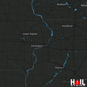 DAVENPORT (KDVN) RADAR

