This weather event on October 5, 2025 includes:
3 states
23 counties,
11 cities,
and 57 zip codes.
There were 174 total properties that were impacted and have possible damage.
States Impacted By Hail On October 5, 2025
Iowa
·
Missouri
·
Nebraska
Counties Impacted By Hail On October 5, 2025
Adair, IA
·
Adams, IA
·
Audubon, IA
·
Butler, IA
·
Cass, IA
·
Cerro Gordo, IA
·
Dallas, IA
·
Floyd, IA
·
Franklin, IA
·
Fremont, IA
·
Greene, IA
·
Guthrie, IA
·
Hancock, IA
·
Humboldt, IA
·
Kossuth, IA
·
Mills, IA
·
Mitchell, IA
·
Montgomery, IA
·
Wright, IA
·
Atchison, MO
·
Cass, NE
·
Nemaha, NE
·
Otoe, NE
Cities Impacted By Hail On October 5, 2025
Brock, NE
·
Emerson, IA
·
Grant, IA
·
Hastings, IA
·
Jefferson, IA
·
Julian, NE
·
Latimer, IA
·
Malvern, IA
·
Randolph, IA
·
Red Oak, IA
·
Rockford, IA
Zip Codes Impacted By Hail On October 5, 2025
50025
·
50048
·
50064
·
50071
·
50076
·
50115
·
50117
·
50164
·
50167
·
50217
·
50220
·
50235
·
50274
·
50276
·
50423
·
50435
·
50441
·
50452
·
50460
·
50461
·
50468
·
50471
·
50519
·
50558
·
50560
·
50616
·
50619
·
50633
·
50636
·
50658
·
50841
·
50843
·
50847
·
50859
·
50864
·
51532
·
51533
·
51534
·
51535
·
51540
·
51544
·
51551
·
51561
·
51566
·
51573
·
51640
·
51649
·
51653
·
68048
·
68305
·
68320
·
68379
·
68409
·
68410
·
68421
·
68448
·
50129
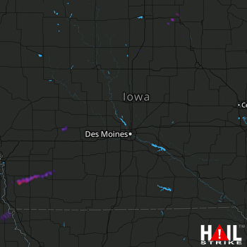 DES MOINES (KDMX) RADAR

