This weather event on October 5, 2025 includes:
1 states
23 counties,
13 cities,
and 72 zip codes.
There were 1240 total properties that were impacted and have possible damage.
States Impacted By Hail On October 5, 2025
Kansas
Counties Impacted By Hail On October 5, 2025
Barton, KS
·
Edwards, KS
·
Ellis, KS
·
Ellsworth, KS
·
Finney, KS
·
Ford, KS
·
Grant, KS
·
Gray, KS
·
Haskell, KS
·
Hodgeman, KS
·
Lane, KS
·
Lincoln, KS
·
Meade, KS
·
Mitchell, KS
·
Ness, KS
·
Osborne, KS
·
Pawnee, KS
·
Phillips, KS
·
Rooks, KS
·
Rush, KS
·
Russell, KS
·
Seward, KS
·
Trego, KS
Cities Impacted By Hail On October 5, 2025
Dodge City, KS
·
Ellis, KS
·
Galatia, KS
·
Garden City, KS
·
Luray, KS
·
McCracken, KS
·
Munjor, KS
·
Ness City, KS
·
Osborne, KS
·
Paradise, KS
·
Timken, KS
·
Tipton, KS
·
Waldo, KS
Zip Codes Impacted By Hail On October 5, 2025
67418
·
67420
·
67430
·
67437
·
67439
·
67446
·
67450
·
67452
·
67455
·
67459
·
67473
·
67481
·
67485
·
67490
·
67511
·
67513
·
67516
·
67518
·
67520
·
67521
·
67523
·
67525
·
67544
·
67548
·
67556
·
67559
·
67560
·
67563
·
67564
·
67565
·
67574
·
67575
·
67601
·
67621
·
67623
·
67634
·
67637
·
67639
·
67640
·
67646
·
67648
·
67649
·
67651
·
67658
·
67660
·
67661
·
67663
·
67665
·
67669
·
67671
·
67673
·
67675
·
67801
·
67834
·
67835
·
67837
·
67839
·
67841
·
67842
·
67846
·
67849
·
67853
·
67854
·
67859
·
67867
·
67868
·
67869
·
67870
·
67876
·
67877
·
67880
·
67882
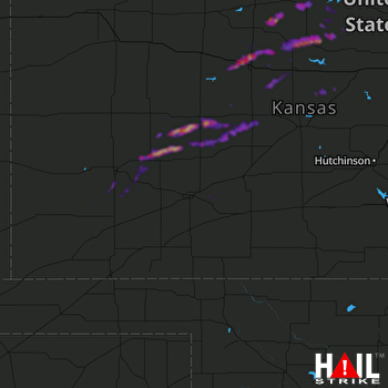 DODGE CITY (KDDC) RADAR

