This weather event on October 4, 2025 includes:
2 states
19 counties,
14 cities,
and 74 zip codes.
There were 1833 total properties that were impacted and have possible damage.
States Impacted By Hail On October 4, 2025
Minnesota
·
North Dakota
Counties Impacted By Hail On October 4, 2025
Beltrami, MN
·
Kittson, MN
·
Marshall, MN
·
Roseau, MN
·
Barnes, ND
·
Benson, ND
·
Eddy, ND
·
Foster, ND
·
Grand Forks, ND
·
Griggs, ND
·
LaMoure, ND
·
Logan, ND
·
Nelson, ND
·
Pembina, ND
·
Ramsey, ND
·
Steele, ND
·
Stutsman, ND
·
Walsh, ND
·
Wells, ND
Cities Impacted By Hail On October 4, 2025
Badger, MN
·
Donaldson, MN
·
Greenbush, MN
·
Halma, MN
·
Karlstad, MN
·
Kennedy, MN
·
Lake Bronson, MN
·
Larimore, ND
·
Leal, ND
·
Montpelier, ND
·
Roseau, MN
·
Sharon, ND
·
St. Thomas, ND
·
Ypsilanti, ND
Zip Codes Impacted By Hail On October 4, 2025
56673
·
56713
·
56714
·
56720
·
56725
·
56726
·
56727
·
56728
·
56729
·
56732
·
56733
·
56734
·
56735
·
56737
·
56744
·
56751
·
56756
·
56757
·
56758
·
56759
·
56761
·
56763
·
58212
·
58214
·
58224
·
58225
·
58231
·
58235
·
58237
·
58238
·
58243
·
58251
·
58256
·
58258
·
58261
·
58267
·
58271
·
58272
·
58273
·
58276
·
58277
·
58301
·
58327
·
58338
·
58356
·
58370
·
58377
·
58381
·
58401
·
58418
·
58421
·
58424
·
58425
·
58426
·
58429
·
58433
·
58442
·
58443
·
58448
·
58454
·
58455
·
58456
·
58464
·
58467
·
58472
·
58476
·
58479
·
58480
·
58481
·
58483
·
58486
·
58492
·
58496
·
58497
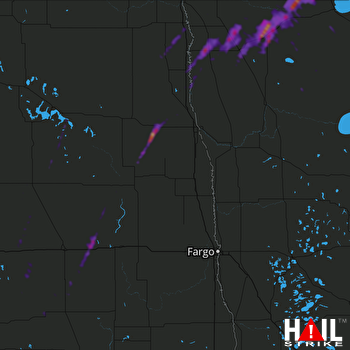 GRAND FORKS (KMVX) RADAR

