This weather event on October 2, 2025 includes:
3 states
22 counties,
23 cities,
and 73 zip codes.
There were 323 total properties that were impacted and have possible damage.
States Impacted By Hail On October 2, 2025
Arkansas
·
Louisiana
·
Texas
Counties Impacted By Hail On October 2, 2025
Union, AR
·
Acadia, LA
·
Allen, LA
·
Beauregard, LA
·
Calcasieu, LA
·
Cameron, LA
·
De Soto, LA
·
Iberia, LA
·
Jefferson Davis, LA
·
Lincoln, LA
·
Natchitoches, LA
·
Rapides, LA
·
Sabine, LA
·
Vermilion, LA
·
Vernon, LA
·
Hardin, TX
·
Jasper, TX
·
Nacogdoches, TX
·
Newton, TX
·
Orange, TX
·
Sabine, TX
·
Shelby, TX
Cities Impacted By Hail On October 2, 2025
Belmont, LA
·
Cameron, LA
·
Carlyss, LA
·
DeQuincy, LA
·
Elizabeth, LA
·
Grambling, LA
·
Hackberry, LA
·
Hornbeck, LA
·
Jennings, LA
·
Lacassine, LA
·
Lake Charles, LA
·
Merryville, LA
·
Moss Bluff, LA
·
Nacogdoches, TX
·
Natchitoches, LA
·
Orange, TX
·
Pitkin, LA
·
Prien, LA
·
Ruston, LA
·
Simsboro, LA
·
South Toledo Bend, TX
·
Welsh, LA
·
Westlake, LA
Zip Codes Impacted By Hail On October 2, 2025
70531
·
70533
·
70542
·
70546
·
70548
·
70581
·
70591
·
70601
·
70605
·
70615
·
70631
·
70632
·
70633
·
70634
·
70638
·
70639
·
70640
·
70643
·
70644
·
70645
·
70647
·
70648
·
70650
·
70651
·
70652
·
70653
·
70656
·
70657
·
70658
·
70660
·
70661
·
70665
·
70668
·
70669
·
71001
·
71245
·
71270
·
71275
·
71403
·
71406
·
71416
·
71419
·
71429
·
71433
·
71438
·
71446
·
71447
·
71449
·
71450
·
71455
·
71457
·
71468
·
71486
·
71730
·
71749
·
75928
·
75932
·
75935
·
75948
·
75951
·
75956
·
75964
·
75966
·
75972
·
75973
·
75977
·
77630
·
77632
·
77656
·
70510
·
70534
·
70611
·
71439
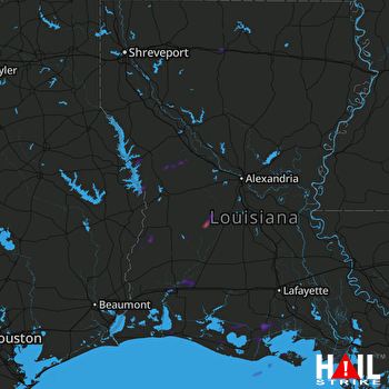 FORT POLK (KPOE) RADAR

