This weather event on September 26, 2025 includes:
1 states
20 counties,
18 cities,
and 60 zip codes.
There were total properties that were impacted and have possible damage.
States Impacted By Hail On September 26, 2025
Virginia
Counties Impacted By Hail On September 26, 2025
Brunswick, VA
·
Charles City, VA
·
Chesterfield, VA
·
Dinwiddie, VA
·
Gloucester, VA
·
Hampton, VA
·
Hopewell, VA
·
Isle of Wight, VA
·
James City, VA
·
King and Queen, VA
·
Lunenburg, VA
·
Newport News, VA
·
Northampton, VA
·
Nottoway, VA
·
Poquoson, VA
·
Prince George, VA
·
Southampton, VA
·
Surry, VA
·
Sussex, VA
·
York, VA
Cities Impacted By Hail On September 26, 2025
Blackstone, VA
·
Charles City, VA
·
Dendron, VA
·
Eastville, VA
·
Gloucester Point, VA
·
Hampton, VA
·
Hopewell, VA
·
Lunenburg, VA
·
Newport News, VA
·
Poquoson, VA
·
Rushmere, VA
·
Scotland, VA
·
Smithfield, VA
·
Surry, VA
·
Victoria, VA
·
Wakefield, VA
·
Waverly, VA
·
Yorktown, VA
Zip Codes Impacted By Hail On September 26, 2025
23030
·
23061
·
23062
·
23316
·
23347
·
23405
·
23601
·
23602
·
23603
·
23604
·
23605
·
23606
·
23608
·
23662
·
23664
·
23665
·
23666
·
23669
·
23690
·
23692
·
23693
·
23696
·
23803
·
23805
·
23821
·
23824
·
23830
·
23833
·
23839
·
23840
·
23841
·
23846
·
23850
·
23860
·
23866
·
23872
·
23875
·
23876
·
23881
·
23882
·
23883
·
23885
·
23890
·
23894
·
23930
·
23938
·
23942
·
23944
·
23947
·
23954
·
23974
·
23952
·
23888
·
23430
·
23314
·
23310
·
23304
·
23185
·
23156
·
23072
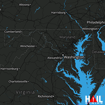 STERLING (KLWX) RADAR

