This weather event on September 25, 2025 includes:
6 states
22 counties,
17 cities,
and 55 zip codes.
There were 188 total properties that were impacted and have possible damage.
States Impacted By Hail On September 25, 2025
Georgia
·
Kentucky
·
North Carolina
·
South Carolina
·
Tennessee
·
Virginia
Counties Impacted By Hail On September 25, 2025
Murray, GA
·
Whitfield, GA
·
Bell, KY
·
Cherokee, NC
·
Cleveland, NC
·
Gaston, NC
·
Madison, NC
·
Wilkes, NC
·
Yancey, NC
·
Cherokee, SC
·
Greenville, SC
·
Pickens, SC
·
Spartanburg, SC
·
Blount, TN
·
Bradley, TN
·
Greene, TN
·
McMinn, TN
·
Monroe, TN
·
Polk, TN
·
Sevier, TN
·
Smyth, VA
·
Washington, VA
Cities Impacted By Hail On September 25, 2025
Adwolf, VA
·
Bessemer City, NC
·
Chesnee, SC
·
Earl, NC
·
Etowah, TN
·
Fingerville, SC
·
Gaffney, SC
·
Gastonia, NC
·
Glade Spring, VA
·
Gramling, SC
·
Inman, SC
·
Kings Mountain, NC
·
Light Oak, NC
·
Mayo, SC
·
Sevierville, TN
·
Shelby, NC
·
Travelers Rest, SC
Zip Codes Impacted By Hail On September 25, 2025
24210
·
24319
·
24340
·
28016
·
28021
·
28073
·
28086
·
28150
·
28152
·
28635
·
28659
·
28665
·
28669
·
28685
·
28714
·
28753
·
28906
·
29322
·
29323
·
29330
·
29338
·
29341
·
29349
·
29368
·
29609
·
29617
·
29640
·
29651
·
29671
·
29687
·
29690
·
29702
·
30710
·
30711
·
30721
·
37303
·
37307
·
37309
·
37310
·
37331
·
37333
·
37369
·
37370
·
37385
·
37616
·
37641
·
37681
·
37743
·
37803
·
37862
·
37876
·
37885
·
40977
·
24354
·
37325
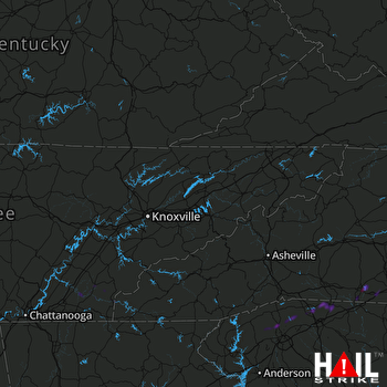 KNOXVILLE (KMRX) RADAR

