This weather event on September 23, 2025 includes:
3 states
26 counties,
14 cities,
and 83 zip codes.
There were 1281 total properties that were impacted and have possible damage.
States Impacted By Hail On September 23, 2025
Arkansas
·
Kansas
·
Missouri
Counties Impacted By Hail On September 23, 2025
Benton, AR
·
Boone, AR
·
Carroll, AR
·
Washington, AR
·
Cherokee, KS
·
Crawford, KS
·
Barry, MO
·
Barton, MO
·
Bates, MO
·
Benton, MO
·
Camden, MO
·
Christian, MO
·
Douglas, MO
·
Greene, MO
·
Henry, MO
·
Hickory, MO
·
Howell, MO
·
Jackson, MO
·
Jasper, MO
·
Lawrence, MO
·
Morgan, MO
·
Newton, MO
·
Pulaski, MO
·
Saline, MO
·
Stone, MO
·
Taney, MO
Cities Impacted By Hail On September 23, 2025
Battlefield, MO
·
Blue Springs, MO
·
Carytown, MO
·
Chesapeake, MO
·
Clever, MO
·
Hurley, MO
·
Lee's Summit, MO
·
Lone Jack, MO
·
Marshall, MO
·
Montreal, MO
·
Pomona, MO
·
Reeds, MO
·
Republic, MO
·
Springfield, MO
Zip Codes Impacted By Hail On September 23, 2025
64014
·
64015
·
64029
·
64064
·
64070
·
64730
·
64735
·
64740
·
64755
·
64832
·
64834
·
64836
·
64840
·
64844
·
64848
·
64855
·
64859
·
64862
·
64870
·
64873
·
65020
·
65052
·
65078
·
65324
·
65326
·
65340
·
65355
·
65556
·
65567
·
65591
·
65604
·
65605
·
65608
·
65610
·
65612
·
65619
·
65631
·
65633
·
65634
·
65637
·
65638
·
65656
·
65664
·
65704
·
65705
·
65707
·
65708
·
65712
·
65717
·
65723
·
65737
·
65738
·
65756
·
65768
·
65769
·
65775
·
65789
·
65793
·
65802
·
65803
·
65806
·
65807
·
65810
·
66724
·
66725
·
66728
·
66739
·
66743
·
66753
·
66762
·
66781
·
72611
·
72616
·
72624
·
72638
·
72704
·
72732
·
72740
·
72762
·
72601
·
65714
·
65646
·
64086
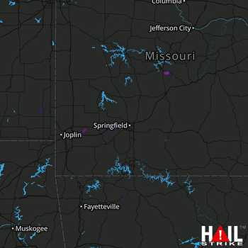 SPRINGFIELD (KSGF) RADAR

