This weather event on September 22, 2025 includes:
3 states
22 counties,
17 cities,
and 63 zip codes.
There were 831 total properties that were impacted and have possible damage.
States Impacted By Hail On September 22, 2025
Michigan
·
Ohio
·
Pennsylvania
Counties Impacted By Hail On September 22, 2025
Lapeer, MI
·
St. Clair, MI
·
Ashland, OH
·
Ashtabula, OH
·
Columbiana, OH
·
Cuyahoga, OH
·
Delaware, OH
·
Geauga, OH
·
Holmes, OH
·
Knox, OH
·
Lake, OH
·
Lorain, OH
·
Mahoning, OH
·
Medina, OH
·
Morrow, OH
·
Richland, OH
·
Stark, OH
·
Trumbull, OH
·
Wayne, OH
·
Crawford, PA
·
Erie, PA
·
Warren, PA
Cities Impacted By Hail On September 22, 2025
Alliance, OH
·
Ashley, OH
·
Beloit, OH
·
Brunswick, OH
·
Capac, MI
·
Columbus, PA
·
Corry, PA
·
Elgin, PA
·
Hills and Dales, OH
·
Killbuck, OH
·
Lake Buckhorn, OH
·
Mansfield, OH
·
North Royalton, OH
·
Platea, PA
·
Spencer, OH
·
Strongsville, OH
·
Youngsville, PA
Zip Codes Impacted By Hail On September 22, 2025
16335
·
16340
·
16350
·
16365
·
16371
·
16401
·
16402
·
16405
·
16406
·
16407
·
16410
·
16412
·
16417
·
16433
·
16438
·
16442
·
43003
·
43015
·
43019
·
43066
·
43315
·
43317
·
43334
·
43338
·
43356
·
44024
·
44047
·
44077
·
44133
·
44136
·
44212
·
44233
·
44235
·
44253
·
44254
·
44256
·
44275
·
44402
·
44410
·
44450
·
44601
·
44609
·
44627
·
44633
·
44637
·
44641
·
44654
·
44691
·
44708
·
44805
·
44822
·
44859
·
44880
·
44902
·
44903
·
44905
·
48002
·
48014
·
48022
·
48444
·
48003
·
44813
·
16436
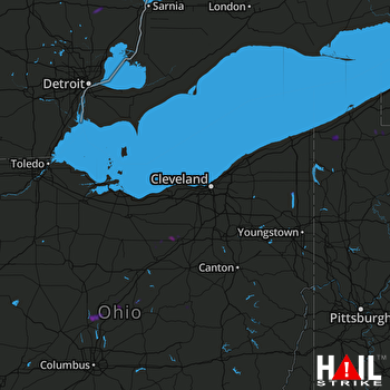 CLEVELAND (KCLE) RADAR

