This weather event on September 21, 2025 includes:
2 states
13 counties,
36 cities,
and 43 zip codes.
There were 150 total properties that were impacted and have possible damage.
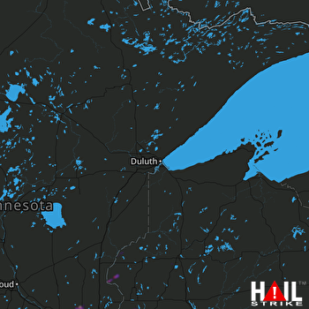 DULUTH (KDLH) RADAR
States Impacted By Hail On September 21, 2025
Minnesota
·
Wisconsin
Counties Impacted By Hail On September 21, 2025
Anoka, MN
·
Chisago, MN
·
Dakota, MN
·
Hennepin, MN
·
Pine, MN
·
Ramsey, MN
·
Sherburne, MN
·
Washington, MN
·
Wright, MN
·
Burnett, WI
·
Polk, WI
·
St. Croix, WI
·
Washburn, WI
Cities Impacted By Hail On September 21, 2025
Afton, MN
·
Albertville, MN
·
Andover, MN
·
Cottage Grove, MN
·
Dayton, MN
·
Deephaven, MN
·
Eagan, MN
·
East Bethel, MN
·
Elk River, MN
·
Harris, MN
·
Hudson, WI
·
Inver Grove Heights, MN
·
Lake Elmo, MN
·
Lakeland, MN
·
Lakeland Shores, MN
·
Lake St. Croix Beach, MN
·
Maplewood, MN
·
Minnetonka, MN
·
Newport, MN
·
North Hudson, WI
·
Nowthen, MN
·
Oak Grove, MN
·
Orono, MN
·
Otsego, MN
·
Ramsey, MN
·
Rogers, MN
·
Shorewood, MN
·
South St. Paul, MN
·
St. Francis, MN
·
St. Marys Point, MN
·
St. Michael, MN
·
St. Paul, MN
·
St. Paul Park, MN
·
Wayzata, MN
·
Woodbury, MN
·
Woodland, MN
Zip Codes Impacted By Hail On September 21, 2025
54001
·
54009
·
54016
·
54020
·
54022
·
54024
·
54801
·
54830
·
54840
·
54871
·
54893
·
55001
·
55005
·
55011
·
55016
·
55032
·
55037
·
55042
·
55043
·
55055
·
55063
·
55070
·
55071
·
55075
·
55076
·
55077
·
55082
·
55106
·
55119
·
55121
·
55125
·
55129
·
55301
·
55303
·
55304
·
55305
·
55313
·
55327
·
55330
·
55345
·
55374
·
55376
·
55391

