This weather event on September 21, 2025 includes:
3 states
26 counties,
18 cities,
and 72 zip codes.
There were 250 total properties that were impacted and have possible damage.
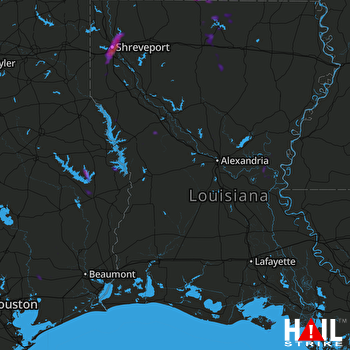 FORT POLK (KPOE) RADAR
States Impacted By Hail On September 21, 2025
Arkansas
·
Louisiana
·
Texas
Counties Impacted By Hail On September 21, 2025
Union, AR
·
Avoyelles, LA
·
Bossier, LA
·
Caddo, LA
·
Catahoula, LA
·
Concordia, LA
·
De Soto, LA
·
Grant, LA
·
Iberia, LA
·
Jackson, LA
·
Lincoln, LA
·
Natchitoches, LA
·
Ouachita, LA
·
Pointe Coupee, LA
·
Sabine, LA
·
Union, LA
·
Vernon, LA
·
West Feliciana, LA
·
Winn, LA
·
Hardin, TX
·
Jasper, TX
·
Jefferson, TX
·
Liberty, TX
·
Newton, TX
·
Sabine, TX
·
San Augustine, TX
Cities Impacted By Hail On September 21, 2025
Ames, TX
·
Bevil Oaks, TX
·
Bossier City, LA
·
Choudrant, LA
·
Converse, LA
·
Daisetta, TX
·
El Dorado, AR
·
Eros, LA
·
Farmerville, LA
·
Grand Cane, LA
·
Hardin, TX
·
Huttig, AR
·
Junction City, AR
·
Lakeview, LA
·
Liberty, TX
·
Marion, LA
·
Shreveport, LA
·
Stonewall, LA
Zip Codes Impacted By Hail On September 21, 2025
70656
·
70715
·
71006
·
71032
·
71046
·
71047
·
71052
·
71078
·
71101
·
71103
·
71104
·
71106
·
71107
·
71108
·
71109
·
71110
·
71111
·
71112
·
71119
·
71129
·
71222
·
71225
·
71226
·
71227
·
71234
·
71235
·
71238
·
71256
·
71260
·
71270
·
71277
·
71316
·
71343
·
71351
·
71354
·
71355
·
71373
·
71404
·
71407
·
71419
·
71423
·
71429
·
71439
·
71446
·
71449
·
71457
·
71467
·
71468
·
71469
·
71483
·
71730
·
71747
·
71749
·
71765
·
75929
·
75930
·
75931
·
75948
·
75951
·
75966
·
75968
·
75977
·
77533
·
77575
·
77585
·
77625
·
77657
·
77713
·
77538
·
71241
·
71118
·
71105

