This weather event on September 21, 2025 includes:
4 states
27 counties,
17 cities,
and 63 zip codes.
There were 949 total properties that were impacted and have possible damage.
States Impacted By Hail On September 21, 2025
Colorado
·
Kansas
·
Oklahoma
·
Texas
Counties Impacted By Hail On September 21, 2025
Prowers, CO
·
Ellis, KS
·
Ellsworth, KS
·
Finney, KS
·
Ford, KS
·
Gove, KS
·
Gray, KS
·
Haskell, KS
·
Hodgeman, KS
·
Kiowa, KS
·
Lane, KS
·
Lincoln, KS
·
McPherson, KS
·
Osborne, KS
·
Reno, KS
·
Rice, KS
·
Rooks, KS
·
Russell, KS
·
Saline, KS
·
Scott, KS
·
Sedgwick, KS
·
Trego, KS
·
Woodward, OK
·
Hansford, TX
·
Hemphill, TX
·
Roberts, TX
·
Sherman, TX
Cities Impacted By Hail On September 21, 2025
Cimarron, KS
·
Dodge City, KS
·
Ellsworth, KS
·
Ensign, KS
·
Geneseo, KS
·
Hays, KS
·
Hutchinson, KS
·
Ingalls, KS
·
Kanopolis, KS
·
Montezuma, KS
·
Munjor, KS
·
Natoma, KS
·
Paradise, KS
·
Plainville, KS
·
Russell, KS
·
South Hutchinson, KS
·
Wright, KS
Zip Codes Impacted By Hail On September 21, 2025
67052
·
67054
·
67109
·
67149
·
67425
·
67439
·
67444
·
67456
·
67457
·
67460
·
67464
·
67481
·
67490
·
67491
·
67501
·
67502
·
67505
·
67521
·
67546
·
67554
·
67572
·
67579
·
67601
·
67626
·
67631
·
67634
·
67637
·
67640
·
67648
·
67651
·
67658
·
67663
·
67665
·
67672
·
67673
·
67752
·
67801
·
67834
·
67835
·
67837
·
67839
·
67841
·
67846
·
67854
·
67865
·
67867
·
67868
·
67871
·
67876
·
67882
·
73801
·
73857
·
73949
·
79011
·
79014
·
79040
·
79059
·
79081
·
79084
·
81041
·
67050
·
67454
·
67853
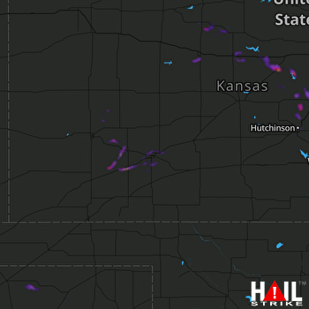 DODGE CITY (KDDC) RADAR

