This weather event on September 20, 2025 includes:
3 states
19 counties,
25 cities,
and 65 zip codes.
There were 807 total properties that were impacted and have possible damage.
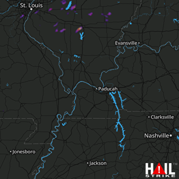 PADUCAH (KPAH) RADAR
States Impacted By Hail On September 20, 2025
Illinois
·
Missouri
·
Tennessee
Counties Impacted By Hail On September 20, 2025
Bond, IL
·
Clinton, IL
·
Effingham, IL
·
Fayette, IL
·
Jefferson, IL
·
Madison, IL
·
Marion, IL
·
Monroe, IL
·
Perry, IL
·
Randolph, IL
·
St. Clair, IL
·
Washington, IL
·
Wayne, IL
·
Butler, MO
·
Jefferson, MO
·
Ripley, MO
·
St. Louis, MO
·
Wayne, MO
·
Robertson, TN
Cities Impacted By Hail On September 20, 2025
Addieville, IL
·
Alorton, IL
·
Beckemeyer, IL
·
Belleville, IL
·
Caseyville, IL
·
Centreville, IL
·
Cisne, IL
·
Collinsville, IL
·
Concord, MO
·
Crestwood, MO
·
East St. Louis, IL
·
Fairfield, IL
·
Fairview Heights, IL
·
Fenton, MO
·
Grantwood Village, MO
·
Greenville, IL
·
Junction City, IL
·
Mount Vernon, IL
·
Murphy, MO
·
Sandoval, IL
·
Sappington, MO
·
Springfield, TN
·
Sunset Hills, MO
·
Waltonville, IL
·
Waterloo, IL
Zip Codes Impacted By Hail On September 20, 2025
62203
·
62205
·
62206
·
62207
·
62208
·
62214
·
62218
·
62223
·
62230
·
62231
·
62232
·
62234
·
62237
·
62246
·
62249
·
62253
·
62254
·
62257
·
62260
·
62262
·
62263
·
62264
·
62268
·
62271
·
62274
·
62275
·
62281
·
62284
·
62285
·
62293
·
62294
·
62298
·
62411
·
62426
·
62443
·
62446
·
62458
·
62473
·
62801
·
62808
·
62823
·
62824
·
62831
·
62842
·
62849
·
62864
·
62868
·
62870
·
62875
·
62882
·
62883
·
62894
·
62898
·
62899
·
63026
·
63123
·
63127
·
63128
·
63935
·
63967
·
37172
·
62219
·
62837
·
62878
·
63126

