This weather event on September 20, 2025 includes:
2 states
17 counties,
32 cities,
and 77 zip codes.
There were 105 total properties that were impacted and have possible damage.
States Impacted By Hail On September 20, 2025
Kansas
·
Oklahoma
Counties Impacted By Hail On September 20, 2025
Chautauqua, KS
·
Cowley, KS
·
Harper, KS
·
Sumner, KS
·
Alfalfa, OK
·
Garfield, OK
·
Grant, OK
·
Kay, OK
·
Mayes, OK
·
Noble, OK
·
Nowata, OK
·
Osage, OK
·
Pawnee, OK
·
Payne, OK
·
Rogers, OK
·
Tulsa, OK
·
Washington, OK
Cities Impacted By Hail On September 20, 2025
Adair, OK
·
Anthony, KS
·
Argonia, KS
·
Billings, OK
·
Blackburn, OK
·
Blackwell, OK
·
Bushyhead, OK
·
Chelsea, OK
·
Claremore, OK
·
Cleveland, OK
·
Danville, KS
·
Deer Creek, OK
·
Foyil, OK
·
Freeport, KS
·
Hominy, OK
·
McCord, OK
·
Medford, OK
·
Milan, KS
·
Morrison, OK
·
Nardin, OK
·
New Alluwe, OK
·
Nowata, OK
·
Oologah, OK
·
Osage, OK
·
Ponca City, OK
·
Ralston, OK
·
Sedan, KS
·
Sequoyah, OK
·
Skiatook, OK
·
Talala, OK
·
Tonkawa, OK
·
Wellington, KS
Zip Codes Impacted By Hail On September 20, 2025
67003
·
67004
·
67005
·
67018
·
67022
·
67024
·
67031
·
67036
·
67049
·
67051
·
67058
·
67103
·
67105
·
67140
·
67152
·
67346
·
67352
·
67353
·
67360
·
67361
·
73061
·
73077
·
73701
·
73703
·
73717
·
73719
·
73728
·
73736
·
73738
·
73749
·
73753
·
73758
·
73759
·
73761
·
73766
·
73771
·
74016
·
74017
·
74019
·
74020
·
74021
·
74022
·
74027
·
74035
·
74038
·
74048
·
74053
·
74054
·
74056
·
74058
·
74061
·
74070
·
74075
·
74080
·
74330
·
74361
·
74601
·
74604
·
74630
·
74631
·
74632
·
74633
·
74636
·
74637
·
74643
·
74644
·
74646
·
74647
·
74650
·
74651
·
74652
·
74653
·
74641
·
74640
·
74060
·
74032
·
73722
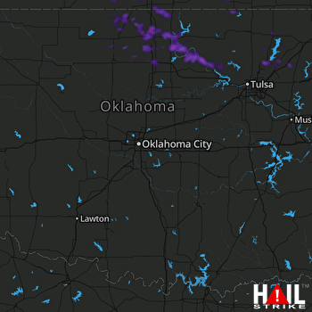 OKLAHOMA CITY (KTLX) RADAR

