This weather event on September 19, 2025 includes:
3 states
22 counties,
21 cities,
and 64 zip codes.
There were 2556 total properties that were impacted and have possible damage.
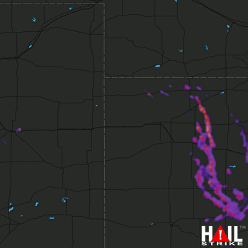 GOODLAND (KGLD) RADAR
States Impacted By Hail On September 19, 2025
Colorado
·
Kansas
·
Nebraska
Counties Impacted By Hail On September 19, 2025
Elbert, CO
·
Lincoln, CO
·
Decatur, KS
·
Edwards, KS
·
Ellis, KS
·
Finney, KS
·
Gove, KS
·
Graham, KS
·
Gray, KS
·
Hodgeman, KS
·
Lane, KS
·
Ness, KS
·
Norton, KS
·
Pawnee, KS
·
Phillips, KS
·
Rawlins, KS
·
Rooks, KS
·
Rush, KS
·
Sheridan, KS
·
Trego, KS
·
Franklin, NE
·
Harlan, NE
Cities Impacted By Hail On September 19, 2025
Atwood, KS
·
Bazine, KS
·
Burdett, KS
·
Collyer, KS
·
Damar, KS
·
Ellis, KS
·
Gove City, KS
·
Hanston, KS
·
Hays, KS
·
Hoxie, KS
·
Huntley, NE
·
Jetmore, KS
·
Naponee, NE
·
Oberlin, KS
·
Palco, KS
·
Park, KS
·
Quinter, KS
·
Republican City, NE
·
Schoenchen, KS
·
Selden, KS
·
Utica, KS
Zip Codes Impacted By Hail On September 19, 2025
66951
·
67513
·
67515
·
67516
·
67518
·
67520
·
67521
·
67523
·
67547
·
67548
·
67553
·
67556
·
67559
·
67560
·
67572
·
67574
·
67584
·
67601
·
67621
·
67625
·
67629
·
67631
·
67632
·
67635
·
67637
·
67642
·
67643
·
67645
·
67650
·
67653
·
67654
·
67657
·
67660
·
67661
·
67663
·
67667
·
67672
·
67730
·
67736
·
67737
·
67738
·
67739
·
67740
·
67744
·
67745
·
67749
·
67751
·
67752
·
67757
·
67835
·
67839
·
67849
·
67854
·
67876
·
68920
·
68939
·
68949
·
68960
·
68966
·
68967
·
68971
·
80818
·
80828
·
80830

