This weather event on September 19, 2025 includes:
2 states
19 counties,
19 cities,
and 70 zip codes.
There were 53 total properties that were impacted and have possible damage.
States Impacted By Hail On September 19, 2025
Arkansas
·
Missouri
Counties Impacted By Hail On September 19, 2025
Arkansas, AR
·
Clay, AR
·
Cleburne, AR
·
Craighead, AR
·
Greene, AR
·
Independence, AR
·
Jackson, AR
·
Jefferson, AR
·
Lawrence, AR
·
Monroe, AR
·
Randolph, AR
·
Stone, AR
·
White, AR
·
Woodruff, AR
·
Butler, MO
·
Cape Girardeau, MO
·
Dunklin, MO
·
Ripley, MO
·
Stoddard, MO
Cities Impacted By Hail On September 19, 2025
Allenville, MO
·
Augusta, AR
·
Batesville, AR
·
Concord, AR
·
Fairdealing, MO
·
Jonesboro, AR
·
Lafe, AR
·
Mountain View, AR
·
Newport, AR
·
Oil Trough, AR
·
Oxly, MO
·
Patterson, AR
·
Pollard, AR
·
Poplar Bluff, MO
·
Reyno, AR
·
Southside, AR
·
Tumbling Shoals, AR
·
Walnut Ridge, AR
·
Whitewater, MO
Zip Codes Impacted By Hail On September 19, 2025
63730
·
63735
·
63739
·
63740
·
63755
·
63785
·
63901
·
63933
·
63935
·
63939
·
63945
·
63953
·
63954
·
63955
·
63961
·
72006
·
72010
·
72020
·
72036
·
72042
·
72051
·
72074
·
72101
·
72112
·
72121
·
72123
·
72137
·
72160
·
72165
·
72169
·
72179
·
72401
·
72404
·
72410
·
72413
·
72416
·
72422
·
72425
·
72434
·
72435
·
72436
·
72443
·
72444
·
72453
·
72454
·
72455
·
72456
·
72460
·
72462
·
72470
·
72471
·
72473
·
72476
·
72501
·
72523
·
72527
·
72530
·
72543
·
72546
·
72550
·
72555
·
72560
·
72564
·
72567
·
72571
·
72581
·
72645
·
72568
·
72534
·
72055
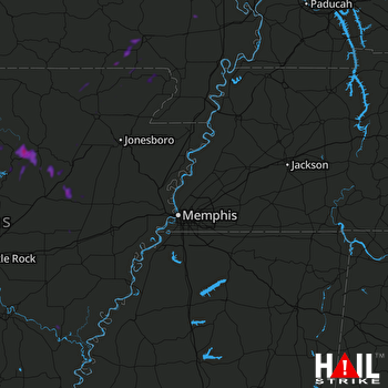 MEMPHIS (KNQA) RADAR

