This weather event on September 18, 2025 includes:
2 states
14 counties,
23 cities,
and 54 zip codes.
There were total properties that were impacted and have possible damage.
States Impacted By Hail On September 18, 2025
Kansas
·
Missouri
Counties Impacted By Hail On September 18, 2025
Lincoln, KS
·
Lyon, KS
·
Ottawa, KS
·
Barton, MO
·
Bates, MO
·
Cass, MO
·
Cedar, MO
·
Henry, MO
·
Holt, MO
·
Jackson, MO
·
Johnson, MO
·
Lafayette, MO
·
St. Clair, MO
·
Vernon, MO
Cities Impacted By Hail On September 18, 2025
Belton, MO
·
Brownington, MO
·
Butler, MO
·
Centerview, MO
·
Concordia, MO
·
Deepwater, MO
·
El Dorado Springs, MO
·
Emporia, KS
·
Grandview, MO
·
Harrisonville, MO
·
Hartwell, MO
·
Kansas City, MO
·
Knob Noster, MO
·
Lake Lotawana, MO
·
Lee's Summit, MO
·
Lone Jack, MO
·
Oak Grove, MO
·
Passaic, MO
·
Pleasant Hill, MO
·
Sheldon, MO
·
Unity Village, MO
·
Warrensburg, MO
·
Whiteman AFB, MO
Zip Codes Impacted By Hail On September 18, 2025
64011
·
64012
·
64019
·
64020
·
64029
·
64030
·
64034
·
64040
·
64064
·
64070
·
64074
·
64075
·
64080
·
64086
·
64088
·
64093
·
64134
·
64136
·
64137
·
64139
·
64145
·
64146
·
64147
·
64437
·
64701
·
64720
·
64724
·
64726
·
64730
·
64733
·
64735
·
64739
·
64740
·
64742
·
64744
·
64747
·
64750
·
64759
·
64761
·
64763
·
64770
·
64772
·
64780
·
64783
·
64784
·
64788
·
64790
·
65305
·
65323
·
65336
·
66801
·
67418
·
67422
·
67467
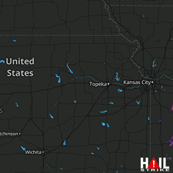 TOPEKA (KTWX) RADAR

