This weather event on September 17, 2025 includes:
3 states
29 counties,
11 cities,
and 65 zip codes.
There were 350 total properties that were impacted and have possible damage.
States Impacted By Hail On September 17, 2025
Colorado
·
Kansas
·
Nebraska
Counties Impacted By Hail On September 17, 2025
Bent, CO
·
Crowley, CO
·
El Paso, CO
·
Lincoln, CO
·
Otero, CO
·
Phillips, CO
·
Prowers, CO
·
Pueblo, CO
·
Sedgwick, CO
·
Ellis, KS
·
Finney, KS
·
Ford, KS
·
Grant, KS
·
Gray, KS
·
Haskell, KS
·
Hodgeman, KS
·
Kearny, KS
·
Morton, KS
·
Ness, KS
·
Rush, KS
·
Sherman, KS
·
Stanton, KS
·
Stevens, KS
·
Thomas, KS
·
Chase, NE
·
Frontier, NE
·
Hayes, NE
·
Perkins, NE
·
Red Willow, NE
Cities Impacted By Hail On September 17, 2025
Alexander, KS
·
Amherst, CO
·
Garden City, KS
·
Goodland, KS
·
Granada, CO
·
Hanston, KS
·
Hayes Center, NE
·
Holly, CO
·
Munjor, KS
·
Ordway, CO
·
Ulysses, KS
Zip Codes Impacted By Hail On September 17, 2025
67513
·
67516
·
67520
·
67523
·
67548
·
67553
·
67556
·
67559
·
67560
·
67660
·
67671
·
67701
·
67732
·
67733
·
67735
·
67741
·
67835
·
67846
·
67849
·
67853
·
67854
·
67855
·
67860
·
67868
·
67870
·
67877
·
67880
·
67882
·
67951
·
67954
·
69001
·
69020
·
69022
·
69023
·
69025
·
69032
·
69033
·
69034
·
69038
·
69040
·
69042
·
69045
·
69134
·
69140
·
69168
·
80721
·
80734
·
80737
·
80744
·
80808
·
80833
·
80864
·
81041
·
81047
·
81050
·
81052
·
81054
·
81062
·
81063
·
81067
·
81076
·
81092
·
67601
·
67743
·
81025
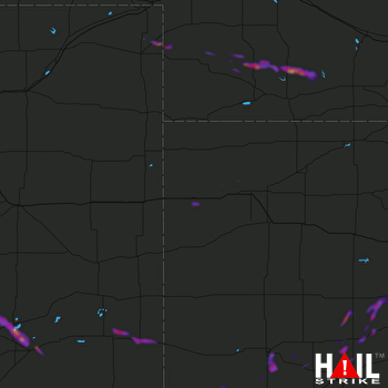 GOODLAND (KGLD) RADAR

