This weather event on September 17, 2025 includes:
4 states
26 counties,
5 cities,
and 69 zip codes.
There were total properties that were impacted and have possible damage.
States Impacted By Hail On September 17, 2025
Iowa
·
Kansas
·
Missouri
·
Nebraska
Counties Impacted By Hail On September 17, 2025
Fremont, IA
·
Mills, IA
·
Barton, KS
·
Cloud, KS
·
Ellsworth, KS
·
Jewell, KS
·
Lincoln, KS
·
Marshall, KS
·
Mitchell, KS
·
Nemaha, KS
·
Osborne, KS
·
Ottawa, KS
·
Republic, KS
·
Rice, KS
·
Russell, KS
·
Saline, KS
·
Atchison, MO
·
Cass, NE
·
Gage, NE
·
Johnson, NE
·
Lancaster, NE
·
Nemaha, NE
·
Otoe, NE
·
Pawnee, NE
·
Saline, NE
·
Seward, NE
Cities Impacted By Hail On September 17, 2025
Burr, NE
·
Lucas, KS
·
Pawnee City, NE
·
Seward, NE
·
Tecumseh, NE
Zip Codes Impacted By Hail On September 17, 2025
51533
·
51540
·
51551
·
51601
·
51639
·
51640
·
51645
·
51649
·
66404
·
66518
·
66538
·
66901
·
66939
·
66942
·
66948
·
66963
·
66966
·
67418
·
67420
·
67422
·
67423
·
67425
·
67427
·
67437
·
67439
·
67450
·
67455
·
67457
·
67459
·
67467
·
67481
·
67484
·
67485
·
67490
·
67524
·
67526
·
67573
·
67579
·
67626
·
67634
·
67648
·
67649
·
68301
·
68313
·
68324
·
68333
·
68344
·
68345
·
68357
·
68358
·
68372
·
68381
·
68410
·
68413
·
68417
·
68418
·
68420
·
68421
·
68434
·
68441
·
68443
·
68447
·
68450
·
68454
·
68455
·
68466
·
68380
·
68323
·
66403
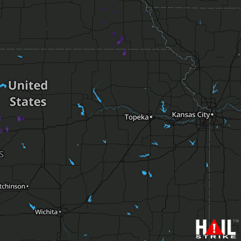 TOPEKA (KTWX) RADAR

