This weather event on September 15, 2025 includes:
3 states
28 counties,
22 cities,
and 73 zip codes.
There were 2352 total properties that were impacted and have possible damage.
States Impacted By Hail On September 15, 2025
Arkansas
·
Mississippi
·
Tennessee
Counties Impacted By Hail On September 15, 2025
Lee, AR
·
St. Francis, AR
·
Attala, MS
·
Benton, MS
·
Calhoun, MS
·
Carroll, MS
·
Choctaw, MS
·
Clarke, MS
·
DeSoto, MS
·
Grenada, MS
·
Holmes, MS
·
Lafayette, MS
·
Marshall, MS
·
Montgomery, MS
·
Neshoba, MS
·
Newton, MS
·
Panola, MS
·
Quitman, MS
·
Tallahatchie, MS
·
Tate, MS
·
Webster, MS
·
Yalobusha, MS
·
Crockett, TN
·
Fayette, TN
·
Hardeman, TN
·
Haywood, TN
·
Lauderdale, TN
·
Tipton, TN
Cities Impacted By Hail On September 15, 2025
Batesville, MS
·
Brownsville, TN
·
Byhalia, MS
·
Covington, TN
·
French Camp, MS
·
Grenada, MS
·
Hernando, MS
·
Holcomb, MS
·
Holly Springs, MS
·
Horn Lake, MS
·
Lexington, MS
·
Moscow, TN
·
Oakland, TN
·
Oxford, MS
·
Ripley, TN
·
Sardis, MS
·
Somerville, TN
·
Southaven, MS
·
Taylor, MS
·
Tucker, MS
·
Union, MS
·
Williston, TN
Zip Codes Impacted By Hail On September 15, 2025
38001
·
38006
·
38011
·
38012
·
38019
·
38028
·
38034
·
38037
·
38040
·
38049
·
38057
·
38060
·
38063
·
38066
·
38068
·
38069
·
38075
·
38076
·
38606
·
38611
·
38619
·
38620
·
38632
·
38635
·
38637
·
38641
·
38642
·
38651
·
38655
·
38661
·
38666
·
38668
·
38671
·
38672
·
38680
·
38685
·
38901
·
38914
·
38915
·
38916
·
38917
·
38920
·
38922
·
38923
·
38925
·
38929
·
38940
·
38943
·
38948
·
38951
·
38953
·
38965
·
38967
·
39095
·
39108
·
39160
·
39192
·
39301
·
39350
·
39355
·
39363
·
39365
·
39737
·
39744
·
39745
·
39767
·
39772
·
72320
·
72346
·
72348
·
72360
·
38673
·
38643
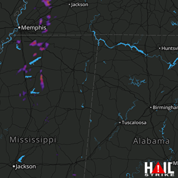 COLUMBUS AFB (KGWX) RADAR

