This weather event on September 15, 2025 includes:
3 states
19 counties,
29 cities,
and 69 zip codes.
There were 209 total properties that were impacted and have possible damage.
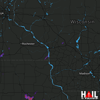 LA CROSSE (KARX) RADAR
States Impacted By Hail On September 15, 2025
Iowa
·
Minnesota
·
Wisconsin
Counties Impacted By Hail On September 15, 2025
Allamakee, IA
·
Benton, IA
·
Black Hawk, IA
·
Buchanan, IA
·
Cerro Gordo, IA
·
Hancock, IA
·
Iowa, IA
·
Johnson, IA
·
Linn, IA
·
Tama, IA
·
Winnebago, IA
·
Dodge, MN
·
Faribault, MN
·
Freeborn, MN
·
Houston, MN
·
Mower, MN
·
La Crosse, WI
·
Monroe, WI
·
Vernon, WI
Cities Impacted By Hail On September 15, 2025
Albert Lea, MN
·
Blairstown, IA
·
Blooming Prairie, MN
·
Brandon, IA
·
Brownsville, MN
·
Burchinal, IA
·
Cedar Rapids, IA
·
Central City, IA
·
Clutier, IA
·
Dysart, IA
·
Fairfax, IA
·
Garrison, IA
·
Gilbertville, IA
·
High Amana, IA
·
Independence, IA
·
Lake Mills, IA
·
La Porte City, IA
·
Mason City, IA
·
Middle Amana, IA
·
Mount Auburn, IA
·
Norway, IA
·
Thompson, IA
·
Vinton, IA
·
Walford, IA
·
Walters, MN
·
Washburn, IA
·
Waterloo, IA
·
Watkins, IA
·
West Amana, IA
Zip Codes Impacted By Hail On September 15, 2025
50401
·
50428
·
50436
·
50446
·
50450
·
50453
·
50469
·
50473
·
50482
·
50607
·
50612
·
50626
·
50634
·
50644
·
50648
·
50675
·
50682
·
50701
·
50702
·
50703
·
52160
·
52202
·
52203
·
52209
·
52210
·
52213
·
52214
·
52217
·
52218
·
52224
·
52225
·
52228
·
52229
·
52236
·
52257
·
52302
·
52307
·
52313
·
52318
·
52329
·
52336
·
52338
·
52342
·
52349
·
52351
·
52352
·
52354
·
52404
·
54656
·
54658
·
54660
·
54666
·
55912
·
55917
·
55919
·
55921
·
55924
·
55931
·
56007
·
56009
·
56029
·
56036
·
56045
·
56051
·
56097
·
50478
·
50651
·
52334
·
56016

