This weather event on September 14, 2025 includes:
3 states
18 counties,
20 cities,
and 60 zip codes.
There were 1612 total properties that were impacted and have possible damage.
States Impacted By Hail On September 14, 2025
Indiana
·
Kentucky
·
Tennessee
Counties Impacted By Hail On September 14, 2025
Floyd, IN
·
Harrison, IN
·
Breckinridge, KY
·
Bullitt, KY
·
Christian, KY
·
Daviess, KY
·
Hancock, KY
·
Hardin, KY
·
Jefferson, KY
·
McLean, KY
·
Meade, KY
·
Muhlenberg, KY
·
Ohio, KY
·
Todd, KY
·
Benton, TN
·
Carroll, TN
·
Henry, TN
·
Perry, TN
Cities Impacted By Hail On September 14, 2025
Central City, KY
·
Cleaton, KY
·
Cloverport, KY
·
Elizabeth, IN
·
Elizabethtown, KY
·
Fort Knox, KY
·
Greenville, KY
·
Huntingdon, TN
·
Island, KY
·
Lanesville, IN
·
Livermore, KY
·
Louisville, KY
·
Muldraugh, KY
·
New Albany, IN
·
Powderly, KY
·
Radcliff, KY
·
Rineyville, KY
·
Shively, KY
·
Vine Grove, KY
·
West Point, KY
Zip Codes Impacted By Hail On September 14, 2025
38221
·
38236
·
38256
·
38317
·
38318
·
38320
·
38344
·
40108
·
40111
·
40121
·
40142
·
40143
·
40155
·
40160
·
40162
·
40165
·
40177
·
40203
·
40208
·
40209
·
40210
·
40211
·
40212
·
40213
·
40214
·
40215
·
40216
·
40217
·
40258
·
40272
·
42217
·
42220
·
42240
·
42266
·
42328
·
42330
·
42332
·
42337
·
42343
·
42345
·
42347
·
42348
·
42350
·
42352
·
42366
·
42367
·
42368
·
42376
·
42378
·
42701
·
42724
·
47112
·
47122
·
47135
·
47136
·
47150
·
37096
·
40117
·
40175
·
47117
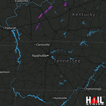 NASHVILLE (KOHX) RADAR

