This weather event on September 7, 2025 includes:
2 states
24 counties,
17 cities,
and 56 zip codes.
There were total properties that were impacted and have possible damage.
States Impacted By Hail On September 7, 2025
Georgia
·
South Carolina
Counties Impacted By Hail On September 7, 2025
Appling, GA
·
Bacon, GA
·
Brantley, GA
·
Bryan, GA
·
Bulloch, GA
·
Chatham, GA
·
Clinch, GA
·
Effingham, GA
·
Evans, GA
·
Liberty, GA
·
Long, GA
·
Lowndes, GA
·
Pierce, GA
·
Tattnall, GA
·
Ware, GA
·
Wayne, GA
·
Allendale, SC
·
Bamberg, SC
·
Barnwell, SC
·
Beaufort, SC
·
Colleton, SC
·
Hampton, SC
·
Jasper, SC
·
Orangeburg, SC
Cities Impacted By Hail On September 7, 2025
Argyle, GA
·
Blackshear, GA
·
Bluffton, SC
·
Brunson, SC
·
Dutch Island, GA
·
Fairfax, SC
·
Georgetown, GA
·
Hagan, GA
·
Hardeeville, SC
·
Hoboken, GA
·
North, SC
·
Port Wentworth, GA
·
Savannah, GA
·
Thunderbolt, GA
·
Valdosta, GA
·
Whitemarsh Island, GA
·
Williston, SC
Zip Codes Impacted By Hail On September 7, 2025
29081
·
29107
·
29112
·
29810
·
29827
·
29853
·
29909
·
29910
·
29911
·
29916
·
29924
·
29929
·
29936
·
29944
·
29945
·
30415
·
30417
·
30427
·
30446
·
30453
·
31301
·
31307
·
31308
·
31312
·
31316
·
31320
·
31321
·
31324
·
31326
·
31329
·
31401
·
31404
·
31405
·
31406
·
31407
·
31410
·
31415
·
31419
·
31503
·
31510
·
31516
·
31518
·
31542
·
31543
·
31545
·
31546
·
31550
·
31551
·
31555
·
31557
·
31601
·
31623
·
31634
·
29927
·
30461
·
31323
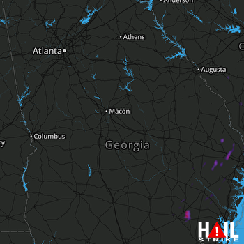 ROBINS AFB (KJGX) RADAR

