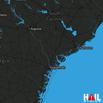
This weather event on September 7, 2025 includes:
2 states
26 counties,
15 cities,
and 54 zip codes.
There were 5115 total properties that were impacted and have possible damage.
States Impacted By Hail On September 7, 2025
Georgia
·
South Carolina
Counties Impacted By Hail On September 7, 2025
Brantley, GA
·
Bryan, GA
·
Bulloch, GA
·
Chatham, GA
·
Effingham, GA
·
Liberty, GA
·
Long, GA
·
Pierce, GA
·
Bamberg, SC
·
Barnwell, SC
·
Beaufort, SC
·
Berkeley, SC
·
Calhoun, SC
·
Charleston, SC
·
Clarendon, SC
·
Colleton, SC
·
Dorchester, SC
·
Florence, SC
·
Georgetown, SC
·
Hampton, SC
·
Horry, SC
·
Jasper, SC
·
Orangeburg, SC
·
Richland, SC
·
Sumter, SC
·
Williamsburg, SC
Cities Impacted By Hail On September 7, 2025
Blackshear, GA
·
Bluffton, SC
·
Branchville, SC
·
Estill, SC
·
Hardeeville, SC
·
Hollywood, SC
·
Port Wentworth, GA
·
Ridgeland, SC
·
Rincon, GA
·
Savannah, GA
·
Scotia, SC
·
Summerville, SC
·
Thunderbolt, GA
·
Turbeville, SC
·
Whitemarsh Island, GA
Zip Codes Impacted By Hail On September 7, 2025
29003
·
29038
·
29039
·
29044
·
29047
·
29112
·
29125
·
29133
·
29148
·
29162
·
29168
·
29414
·
29418
·
29432
·
29446
·
29452
·
29455
·
29483
·
29527
·
29541
·
29554
·
29853
·
29907
·
29909
·
29910
·
29911
·
29918
·
29920
·
29922
·
29924
·
29927
·
29934
·
29936
·
29939
·
29940
·
29944
·
29945
·
30415
·
31307
·
31308
·
31312
·
31326
·
31401
·
31404
·
31405
·
31406
·
31407
·
31410
·
31415
·
31503
·
31516
·
29407
·
29530
·
29916
 CHARLESTON (KCLX) RADAR

