This weather event on September 5, 2025 includes:
4 states
28 counties,
21 cities,
and 76 zip codes.
There were 332 total properties that were impacted and have possible damage.
States Impacted By Hail On September 5, 2025
Arkansas
·
Louisiana
·
Oklahoma
·
Texas
Counties Impacted By Hail On September 5, 2025
Calhoun, AR
·
Hempstead, AR
·
Howard, AR
·
Lafayette, AR
·
Miller, AR
·
Nevada, AR
·
Ouachita, AR
·
Pike, AR
·
Polk, AR
·
Sevier, AR
·
Bienville, LA
·
Bossier, LA
·
Claiborne, LA
·
Webster, LA
·
Choctaw, OK
·
McCurtain, OK
·
Bowie, TX
·
Cass, TX
·
Delta, TX
·
Fannin, TX
·
Franklin, TX
·
Hunt, TX
·
Kaufman, TX
·
Lamar, TX
·
Red River, TX
·
Smith, TX
·
Titus, TX
·
Van Zandt, TX
Cities Impacted By Hail On September 5, 2025
Bodcaw, AR
·
Bradley, AR
·
Caddo Mills, TX
·
Cotton Valley, LA
·
De Queen, AR
·
Dierks, AR
·
Dubberly, LA
·
Garland, AR
·
Garvin, OK
·
Gillham, AR
·
Grannis, AR
·
Grant, OK
·
Hope, AR
·
Ladonia, TX
·
Lewisville, AR
·
Minden, LA
·
Mineral Springs, AR
·
Oakhaven, AR
·
Sibley, LA
·
Terrell, TX
·
Wright City, OK
Zip Codes Impacted By Hail On September 5, 2025
71001
·
71003
·
71006
·
71018
·
71023
·
71024
·
71028
·
71038
·
71039
·
71040
·
71051
·
71055
·
71064
·
71071
·
71072
·
71073
·
71075
·
71744
·
71764
·
71770
·
71801
·
71826
·
71827
·
71832
·
71833
·
71834
·
71835
·
71837
·
71838
·
71841
·
71845
·
71846
·
71851
·
71852
·
71854
·
71858
·
71860
·
71861
·
71937
·
71944
·
71945
·
71950
·
71952
·
71958
·
71959
·
71971
·
71972
·
74728
·
74734
·
74736
·
74738
·
74743
·
74745
·
74764
·
74766
·
74963
·
75103
·
75135
·
75142
·
75147
·
75160
·
75161
·
75169
·
75402
·
75411
·
75449
·
75450
·
75455
·
75487
·
75551
·
75554
·
75556
·
75706
·
75559
·
75432
·
71839
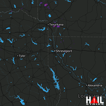 SHREVEPORT (KSHV) RADAR

