This weather event on September 4, 2025 includes:
3 states
24 counties,
26 cities,
and 59 zip codes.
There were 84 total properties that were impacted and have possible damage.
States Impacted By Hail On September 4, 2025
Georgia
·
North Carolina
·
South Carolina
Counties Impacted By Hail On September 4, 2025
Barrow, GA
·
Clarke, GA
·
Greene, GA
·
Jackson, GA
·
Lincoln, GA
·
Madison, GA
·
Oconee, GA
·
Oglethorpe, GA
·
Walton, GA
·
Wilkes, GA
·
Buncombe, NC
·
Cabarrus, NC
·
Cleveland, NC
·
Gaston, NC
·
Henderson, NC
·
Iredell, NC
·
Lincoln, NC
·
McDowell, NC
·
Mecklenburg, NC
·
Polk, NC
·
Rutherford, NC
·
Cherokee, SC
·
Greenville, SC
·
Spartanburg, SC
Cities Impacted By Hail On September 4, 2025
Arnoldsville, GA
·
Athens-Clarke County unified government (balance), GA
·
Belwood, NC
·
Bishop, GA
·
Bogart, GA
·
Carlton, GA
·
Cliffside, NC
·
Comer, GA
·
Crawford, GA
·
Davidson, NC
·
Edneyville, NC
·
Hoopers Creek, NC
·
Huntersville, NC
·
Kannapolis, NC
·
Landrum, SC
·
Lexington, GA
·
Maxeys, GA
·
Mooresville, NC
·
North High Shoals, GA
·
Statham, GA
·
Tignall, GA
·
Tryon, NC
·
Union Point, GA
·
Watkinsville, GA
·
Westport, NC
·
Woodville, GA
Zip Codes Impacted By Hail On September 4, 2025
28006
·
28021
·
28027
·
28031
·
28033
·
28036
·
28037
·
28076
·
28078
·
28080
·
28090
·
28092
·
28114
·
28115
·
28117
·
28139
·
28167
·
28168
·
28650
·
28722
·
28730
·
28732
·
28752
·
28756
·
28761
·
28782
·
28792
·
29323
·
29341
·
29356
·
30601
·
30602
·
30605
·
30606
·
30607
·
30619
·
30621
·
30622
·
30627
·
30628
·
30629
·
30630
·
30633
·
30641
·
30642
·
30648
·
30656
·
30660
·
30666
·
30667
·
30668
·
30669
·
30673
·
30677
·
30680
·
30683
·
30817
·
30609
·
28043
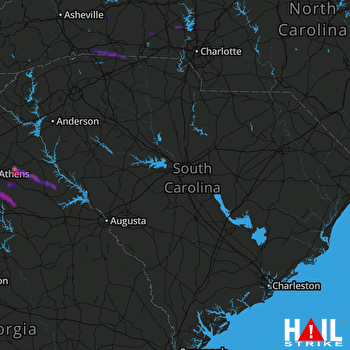 COLUMBIA (KCAE) RADAR

