This weather event on September 4, 2025 includes:
2 states
25 counties,
20 cities,
and 64 zip codes.
There were total properties that were impacted and have possible damage.
States Impacted By Hail On September 4, 2025
Indiana
·
Kentucky
Counties Impacted By Hail On September 4, 2025
Harrison, IN
·
Jefferson, IN
·
Perry, IN
·
Posey, IN
·
Spencer, IN
·
Vanderburgh, IN
·
Warrick, IN
·
Boone, KY
·
Breckinridge, KY
·
Bullitt, KY
·
Daviess, KY
·
Gallatin, KY
·
Grant, KY
·
Grayson, KY
·
Hancock, KY
·
Hardin, KY
·
Harrison, KY
·
Henderson, KY
·
Henry, KY
·
Jefferson, KY
·
Kenton, KY
·
Ohio, KY
·
Owen, KY
·
Scott, KY
·
Trimble, KY
Cities Impacted By Hail On September 4, 2025
Chrisney, IN
·
Cloverport, KY
·
Corinth, KY
·
Crittenden, KY
·
Cynthiana, KY
·
Eminence, KY
·
Evansville, IN
·
Hanover, IN
·
Hardinsburg, KY
·
Hatfield, IN
·
Henderson, KY
·
Maceo, KY
·
Madison, IN
·
Newburgh, IN
·
Owensboro, KY
·
Rockport, IN
·
Spottsville, KY
·
Verona, KY
·
West Point, KY
·
Whitesville, KY
Zip Codes Impacted By Hail On September 4, 2025
40007
·
40019
·
40045
·
40057
·
40111
·
40115
·
40119
·
40140
·
40143
·
40144
·
40145
·
40146
·
40152
·
40162
·
40177
·
40178
·
40272
·
40370
·
41003
·
41010
·
41030
·
41035
·
41092
·
41094
·
41095
·
41097
·
42301
·
42303
·
42348
·
42351
·
42355
·
42366
·
42368
·
42378
·
42420
·
42451
·
42458
·
42701
·
42712
·
42724
·
42732
·
42754
·
47117
·
47243
·
47250
·
47520
·
47531
·
47537
·
47586
·
47588
·
47601
·
47611
·
47615
·
47620
·
47630
·
47634
·
47635
·
47712
·
47713
·
47714
·
47715
·
47720
·
41031
·
40170
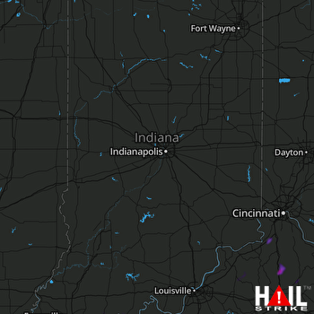 INDIANAPOLIS (KIND) RADAR

