This weather event on September 3, 2025 includes:
2 states
27 counties,
14 cities,
and 59 zip codes.
There were 2158 total properties that were impacted and have possible damage.
States Impacted By Hail On September 3, 2025
Alabama
·
Mississippi
Counties Impacted By Hail On September 3, 2025
Blount, AL
·
Choctaw, AL
·
Cullman, AL
·
Jefferson, AL
·
Lawrence, AL
·
Walker, AL
·
Winston, AL
·
Attala, MS
·
Choctaw, MS
·
Clarke, MS
·
DeSoto, MS
·
Holmes, MS
·
Humphreys, MS
·
Lafayette, MS
·
Leake, MS
·
Leflore, MS
·
Madison, MS
·
Neshoba, MS
·
Noxubee, MS
·
Oktibbeha, MS
·
Pontotoc, MS
·
Scott, MS
·
Sunflower, MS
·
Washington, MS
·
Wayne, MS
·
Winston, MS
·
Yazoo, MS
Cities Impacted By Hail On September 3, 2025
Canton, MS
·
Durant, MS
·
Eden, MS
·
Ethel, MS
·
Hayden, AL
·
Inverness, MS
·
Isola, MS
·
Kosciusko, MS
·
Louise, MS
·
Louisville, MS
·
Moulton, AL
·
Pontotoc, MS
·
Silver City, MS
·
Yazoo City, MS
Zip Codes Impacted By Hail On September 3, 2025
35033
·
35062
·
35077
·
35079
·
35172
·
35180
·
35565
·
35619
·
35643
·
35650
·
35673
·
36908
·
36912
·
36915
·
36919
·
38601
·
38654
·
38655
·
38751
·
38753
·
38754
·
38761
·
38863
·
38946
·
38958
·
39038
·
39039
·
39040
·
39046
·
39051
·
39063
·
39067
·
39071
·
39074
·
39079
·
39090
·
39094
·
39095
·
39097
·
39108
·
39115
·
39146
·
39160
·
39166
·
39169
·
39179
·
39194
·
39301
·
39339
·
39341
·
39350
·
39355
·
39367
·
39735
·
39769
·
35063
·
36904
·
38748
·
39752
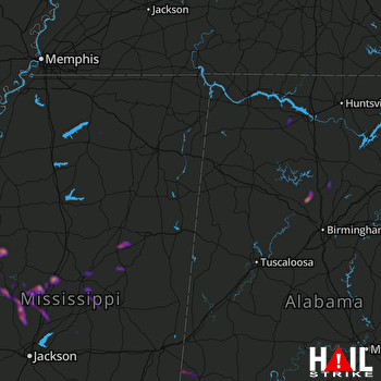 COLUMBUS AFB (KGWX) RADAR

