This weather event on September 3, 2025 includes:
1 states
13 counties,
22 cities,
and 56 zip codes.
There were total properties that were impacted and have possible damage.
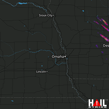 OMAHA (KOAX) RADAR
States Impacted By Hail On September 3, 2025
Iowa
Counties Impacted By Hail On September 3, 2025
Adair, IA
·
Audubon, IA
·
Boone, IA
·
Calhoun, IA
·
Carroll, IA
·
Dallas, IA
·
Greene, IA
·
Guthrie, IA
·
Madison, IA
·
Polk, IA
·
Union, IA
·
Warren, IA
·
Webster, IA
Cities Impacted By Hail On September 3, 2025
Adel, IA
·
Bagley, IA
·
Beaver, IA
·
Bouton, IA
·
Cumming, IA
·
Dana, IA
·
Dawson, IA
·
Des Moines, IA
·
De Soto, IA
·
Earlham, IA
·
Gowrie, IA
·
Grand Junction, IA
·
Jamaica, IA
·
Macksburg, IA
·
Norwalk, IA
·
Rinard, IA
·
Rockwell City, IA
·
Somers, IA
·
Twin Lakes, IA
·
Van Meter, IA
·
Waukee, IA
·
West Des Moines, IA
Zip Codes Impacted By Hail On September 3, 2025
50002
·
50003
·
50026
·
50038
·
50039
·
50048
·
50050
·
50058
·
50061
·
50063
·
50064
·
50066
·
50072
·
50076
·
50107
·
50115
·
50128
·
50129
·
50146
·
50149
·
50155
·
50164
·
50167
·
50211
·
50212
·
50216
·
50217
·
50220
·
50223
·
50235
·
50250
·
50261
·
50263
·
50265
·
50266
·
50273
·
50276
·
50277
·
50312
·
50321
·
50523
·
50538
·
50543
·
50544
·
50563
·
50579
·
50586
·
50801
·
50830
·
50846
·
50849
·
50858
·
51443
·
51449
·
51453
·
51462

