This weather event on August 30, 2025 includes:
3 states
29 counties,
5 cities,
and 66 zip codes.
There were 299 total properties that were impacted and have possible damage.
States Impacted By Hail On August 30, 2025
Colorado
·
Kansas
·
Nebraska
Counties Impacted By Hail On August 30, 2025
Adams, CO
·
Cheyenne, CO
·
Elbert, CO
·
Kiowa, CO
·
Kit Carson, CO
·
Lincoln, CO
·
Phillips, CO
·
Prowers, CO
·
Sedgwick, CO
·
Yuma, CO
·
Finney, KS
·
Ford, KS
·
Gove, KS
·
Graham, KS
·
Gray, KS
·
Hodgeman, KS
·
Lane, KS
·
Ness, KS
·
Pawnee, KS
·
Rawlins, KS
·
Rooks, KS
·
Rush, KS
·
Thomas, KS
·
Trego, KS
·
Chase, NE
·
Cheyenne, NE
·
Dundy, NE
·
Hitchcock, NE
·
Red Willow, NE
Cities Impacted By Hail On August 30, 2025
Bazine, KS
·
Burlington, CO
·
Enders, NE
·
Hanston, KS
·
Kirk, CO
Zip Codes Impacted By Hail On August 30, 2025
67513
·
67515
·
67516
·
67518
·
67521
·
67523
·
67547
·
67556
·
67559
·
67560
·
67572
·
67584
·
67625
·
67632
·
67657
·
67701
·
67730
·
67732
·
67743
·
67745
·
67752
·
67801
·
67835
·
67839
·
67841
·
67846
·
67849
·
67853
·
67854
·
67876
·
69001
·
69021
·
69023
·
69027
·
69030
·
69033
·
69041
·
69043
·
69044
·
69045
·
69162
·
80103
·
80105
·
80701
·
80721
·
80727
·
80734
·
80735
·
80737
·
80744
·
80749
·
80758
·
80802
·
80805
·
80807
·
80815
·
80821
·
80822
·
80823
·
80824
·
80830
·
80832
·
80836
·
81036
·
81045
·
81052
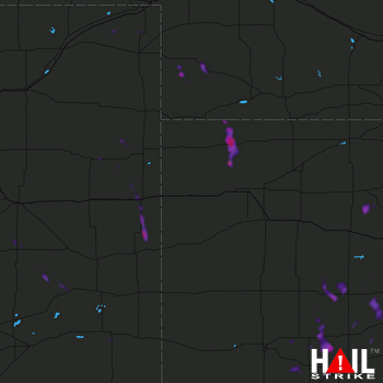 GOODLAND (KGLD) RADAR

